Country:
 City:
City:


Start at the junction of Via Pompei and Via Alessandro Manzoni (parking available nearby or at the start of Via Alessandro Manzoni).
(S/E) Follow the road uphill along the ridge to an unoccupied house. Note that at one point you’ll come across a ‘private road’ sign. The people we met didn’t say anything to us; this walk seems fairly well-known and this is the only access point.
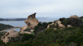
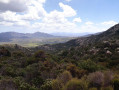
(1) Follow the dirt track as it winds its way into the heath (no markings, but the remains of an old noticeboard that must have described the walk or walks). The path is very narrow but clearly marked. After about a hundred metres, cross the wall – which until now has been on your left – through a small gap and continue through the scrub along the gently ascending path. There are already some lovely views of the mountain and the scrub. On the left, a rocky outcrop that clearly serves as a playground for experienced climbers.
(2) At the junction between the southern and northern paths round the second rocky outcrop, continue to the right, taking the southern route. This seems preferable unless you wish to tackle a more challenging route from the start (the fork isn’t clearly signposted but is clearly visible).
The path climbs steadily through the scrub or undergrowth to a fork that you mustn’t miss.
(3) Turn left onto the path that climbs up the hillside. The gradient is steep, but the path is well-marked and very easy to follow. You’ll reach a first pass before descending onto the eastern slope.
(4) Cross a rocky area where the path is much less clearly marked due to the rather stunted vegetation.
(5) Pass through a wall via a gateway marked by two vertical boulders, which serve as an excellent landmark. You will then begin a descent that occasionally follows a dirt service track.
(6) At the water collection point – recognisable by its relatively new walls and numerous black polyethylene pipes – follow the path that heads up the slope alongside the stream bed (dry in April). You’ll find a path branching off to the left after about 150 metres.
(7) Follow the path as it climbs up the hillside (note that the path shown on the OpenStreetMap hiking base map is in fact only a barely visible track; at this point, a GPS can be very useful). Reach the final pass of the walk, then begin a very steep descent until you rejoin the route taken on the way there.
(2) Turn right onto the path you followed on the way there and head towards San Pantaleo (S/E).

 Visorando Member
 Easy
Easy