


Ben Nevis Route 2
Details
Creation:
Last update:
–
–
-
 Activity: Walking
 -
 Distance: 9.74 mi
 -
 Average duration: 8h 15
 -
 Difficulty: Not specified
 -
-
 Back to start: Yes
 -
 Ascent: + 4,350 ft
 -
 Descent: - 4,344 ft
 -
-
 Highest point: 4,400 ft
 -
 Lowest point: 56 ft
-
 Country:
United Kingdom
Country:
United Kingdom
-
 City:
Highland
City:
Highland -
 Start/End: N 56.805408° / W 5.073493°
 -


 Hour-by-hour weather


Waypoints
- S/E : mi 0 - alt. 56 ft - Start out going south.
- 1 : mi 0.01 - alt. 56 ft - Turn right onto walkway. Proceed southeast (See map for details).
- 2 : mi 0.47 - alt. 62 ft - Turn slight right onto C1162/Glen Nevis Road.
- 3 : mi 0.47 - alt. 62 ft - Turn left onto walkway. Proceed northeast (See map for details).
- 4 : mi 0.5 - alt. 62 ft - Turn right onto Youth hostel Path (Portions unpaved).
- 5 : mi 0.92 - alt. 561 ft - Turn slight right onto Ben Nevis Mountain Path.
- 6 : mi 4.83 - alt. 4,400 ft - Turn slight right onto Route to Ben Nevis from arete.
- 7 : mi 4.9 - alt. 4,400 ft - Route to Ben Nevis from arete becomes Ben Nevis Mountain Path (Portions unpaved).
- 8 : mi 8.81 - alt. 561 ft - Turn slight left onto Youth hostel Path (Portions unpaved).
- 9 : mi 9.23 - alt. 62 ft - Turn left onto walkway. Proceed southwest (See map for details).
- 10 : mi 9.25 - alt. 62 ft - Turn right onto C1162/Glen Nevis Road.
- 11 : mi 9.26 - alt. 62 ft - Turn slight left onto walkway. Proceed northwest (See map for details).
- 12 : mi 9.72 - alt. 56 ft - Turn left.
- S/E : mi 9.74 - alt. 56 ft
Other walks in the area
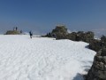
On the rooftop of Great Britain: Ben Nevis
 Visorando Member
 10.00 mi
+4,331 ft
-4,331 ft
8h 20
10.00 mi
+4,331 ft
-4,331 ft
8h 20
 Difficult
 Departure from Highland
Here is a magnificent peak held in high regard by our British friends, Ben Nevis. This summit, though in itself not very high relatively speaking, requires a significant climb in altitude because it starts almost at sea level. During the ascent, the views are breathtaking.
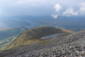
Ben Nevis by the Carn Mor Dearg ridge
 9.52 mi
+5,039 ft
-5,052 ft
8h 45
9.52 mi
+5,039 ft
-5,052 ft
8h 45
 Very difficult
Departure from Highland
Very difficult
Departure from Highland
A very interesting alternative, full of variations, to the normal route to reach the summit of the famous Ben Nevis, the highest peak in Great Britain. It is a wilder variant than the normal route. Without being too technical it remains a solid hike. It allows walkers the opportunity to contemplate the very famous north face of Ben Nevis.
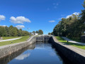
Neptune's Staircase Locks and Caledonian Canal
 Association / Club / Walk leader
 1.03 mi
+43 ft
-62 ft
0h 30
1.03 mi
+43 ft
-62 ft
0h 30
 Easy
Departure from Highland
Easy
Departure from Highland
A little walk to visit Neptune's Staircase 8 Locks and Caledonian Canal.
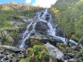
Steall Falls, Ben Nevis area
 1.22 mi
+295 ft
-75 ft
0h 50
1.22 mi
+295 ft
-75 ft
0h 50
 Moderate
Departure from Highland
Moderate
Departure from Highland
A nice walk up the valley nearby Ben Nevis to enjoy Steall Falls.
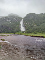
Steall Gorge Waterfall
 2.68 mi
+394 ft
-407 ft
1h 35
Moderate
Departure from Highland
2.68 mi
+394 ft
-407 ft
1h 35
Moderate
Departure from Highland
Located south of Ben Nevis and following the river of the same name (Water of Nevis), this hike to Steall Gorge waterfall is either an alternative to the Mount or a majestic and easy-to-access side walk.
Perfectly signposted, the first part is accessible to all and offers a 150 m view of the entire waterfall.
Crossing a suspension bridge, you can reach the foot of the waterfall, where a prominent rock offers a remarkable podium for hikers.
Aonach Mor and Aonach Beag - two of the "Lochaber giants"
8.10 mi
+4,455 ft
-4,173 ft
7h 35
Difficult
Departure from Highland
This walk in the mountains north of Fort William visits the summits of Aonach Mor and Aonach Beag, both of which exceed 4,000 feet above sea level. The views on a good day are stunning especially of Ben Nevis. The route contains plenty of ascent and you should remember that suitable clothing is essential so you can cope with rapid changes in weather. There are also snow cornices to be considered.
Grey Mares Tail Waterfall, Kinlochmore
 0.60 mi
+98 ft
-98 ft
0h 20
Easy
Departure from Highland
0.60 mi
+98 ft
-98 ft
0h 20
Easy
Departure from Highland
A gentle walk through the woods to discover Grey Mares Tail Waterfall.
The West Highland Way - Stage Five (Kinlochleven to Fort William)
13.93 mi
+1,631 ft
-1,624 ft
7h 50
Difficult
Departure from Highland
The West Highland Way is the most established of Scotland’s long-distance walking routes. This is the fifth of a five stage route, staying at prebooked accomodation along the way. A simple route, with some climbing but mostly sticking to streams and rivers to walk through the valleys whilst appreciating the high mountains from below.
For more walks, use our search engine .
The GPS track and description are the property of this route's author. Please do not copy them without permission.

