Boerschey Dam and Zorn Castle in Bulach, starting from Osthouse

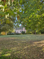
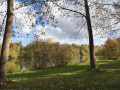
Set off to explore the countryside and the Osthouse Forest, which is magnificent in its beautiful autumn colours. You’ll discover the Boeschey Dam and can admire the Château des Zorn de Bulach from a distance. This walk is easy and suitable for families.

Details

n°85007940
Creation:
Last update:
Last review:
–
  • Walking
    Activity: Walking
  • ↔
    Distance: 6.54 mi
  • ◔
    Average duration: 3h 00 
  • ▲
    Difficulty: Moderate

  • ⚐
    Back to start: Yes
  • ↗
    Ascent: + 10 ft
  • ↘
    Descent: - 10 ft

  • ▲
    Highest point: 515 ft
  • ▼
    Lowest point: 495 ft
  • ⚐ Country: France
  • ⚐ City: Osthouse (67150)
  • ⚑
    Start/End: N 48.403131° / E 7.64666°
  • ❏
    IGN map(s): Ref. 3817O
  • Hour-by-hour weather

Photos

Description of the walk

Park in the car park at the Osthouse Sports Centre and Stadium.

Red Ring signposting

(S/E) Follow Rue des Vergers to the left. After a right-hand bend, join Rue de Gerstheim.

(1) Follow it to the left. On leaving the village, cross the bridge over the Ill and, further on, head towards the cross by the side of the path. Take care: this section runs alongside the road.

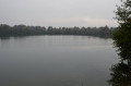
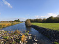
(2) Turn left and follow the path alongside the Ill to reach the Boerschey Dam.

(3) Turn right and follow the path running alongside the Bronnwasser stream until you reach the D131.

(4) Cross it carefully and continue along the path opposite until you reach the next junction where three paths meet.

(5) Turn right and carry on to the next junction.

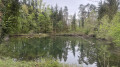
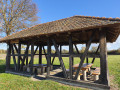
(6) Turn left and head towards the hamlet of Allmend-Hütte, where you’ll find a shelter with tables and chairs. At the shelter, follow the path on your right, which leads further into the Osthouse Forest and passes two private ponds in succession. Continue along this same path until you reach the River Ill.

(7) Turn left and walk alongside the River Ill until you reach the next bridge. Cross it and continue along the path until you reach a junction where there is another bridge on the right.

(8) Cross it and, a little further on, you’ll reach the first houses of the village of Osthouse.

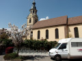
(9) Turn right and follow Rue Zorn de Bulach. Walk past the Château park, then follow Rue du Château to the right. Continue past the church and then the town hall.

(10) After the Town Hall, veer right, ignore the next street on the right, and take the next street on the left (Rue du Looch). At the end of the street, turn right to reach the car park at the starting point: the Osthouse Sports Centre and Stadium (S/E).

Waypoints

  1. S/E : mi 0 - alt. 505 ft - Osthouse Sports Centre and Stadium
  2. 1 : mi 0.25 - alt. 505 ft - Rue de Gerstheim
  3. 2 : mi 0.6 - alt. 505 ft - Cross
  4. 3 : mi 1.38 - alt. 502 ft - Boerschey Dam
  5. 4 : mi 2.37 - alt. 499 ft - Crossing the D131
  6. 5 : mi 3.38 - alt. 505 ft - Junction of 3 paths
  7. 6 : mi 3.66 - alt. 505 ft - Crossroads - Allmendhütte
  8. 7 : mi 4.89 - alt. 505 ft - The River Ill
  9. 8 : mi 5.47 - alt. 505 ft - Bridge over the River Ill - Ill (rivière)
  10. 9 : mi 5.91 - alt. 515 ft - Osthouse – on the right - Château d'Osthouse
  11. 10 : mi 6.26 - alt. 515 ft - Town Hall - Eglise Saint-Barthélemy d'Osthouse
  12. S/E : mi 6.54 - alt. 505 ft - Osthouse Sports Centre and Stadium

Notes

(6) There is a picnic area at Allmend-Hütte, where tables and chairs are provided.
Avoid this walk in heavy rain.

Worth a visit

(3) The Boerschey Dam.
(10) Osthouse Castle, one of the finest Renaissance manor houses in Alsace. The first wing of the château was built in 1436 and the second in 1570. It is also the last château in the Plaine d’Alsace whose moat is filled with water and is still fed by a diversion from the River Ill. Unfortunately, it is not open to the public and can only be admired from a distance.

Other walks in the area

For more walks, use our search engine .

The GPS track and description are the property of this route's author. Please do not copy them without permission.