Country:
 City:
City:


The route starts at the roundabout by the Cimetière du Plateau in Savigny-sur-Orge.
(S/E) Take Avenue Robert Leuthreau (leaving the cemetery on your left). At the junction with Boulevard des Belges, carry straight on, staying on Avenue Robert Leuthreau. Then continue along Avenue Maryse Bastié (Paray-Vieille-Poste).
(1) At the junction with Avenue de Verdun, turn right. At the next roundabout, go straight on along Avenue de Morangis (Athis-Mons). At the junction with the RN7 (at a place called La Belle Étoile), take Avenue Marcel Sembat opposite (turning slightly to the left).
(2) At the roundabout, continue along Avenue Marcel Sembat (third lane on the right). Drive through the old streets of Athis-Mons. Pass close to the vicarage on Rue Etienne Lebeau, then turn left onto Rue Antoine Jean-Baptiste Renoux. At the next roundabout, turn right onto Avenue Henri Dunant.
(3) At the junction with Rue de Champagne and Rue du Général Koënig, turn right onto Rue Robert Schuman. Follow this street north-east for approximately 900 metres.
(4) At the third junction, turn right onto Rue d’Ablon. A few dozen metres further on, on the right at a sharp angle, take the Sentier de l’Egypte (be careful not to take the other path opposite, which leads directly to the Quai de la Seine). This path leads onto Avenue Constance; turn left onto it, then head down the street on the right and rejoin the Sentier de la Fontaine-Garelle on the right. At the junction of the paths, turn left onto the Sentier de l’Ancien Petit Mons. Then turn right onto the Sentier des Germandeaux (signpostedGR®). At the junction with the (paved) Chemin de Fer path, turn left.
(5) When you reach Rue Caron, turn right. You’ll pass the Athis-Mons RER station. At the junction by the station (Place Rotherburg Ob-Der-Tauber), take the D29 straight ahead, towards Juvisy-sur-Orge/Centre Ville. Immediately after the bridge over the River Orge, go down the steps on the right which lead to the path running alongside the River Orge (still signpostedGR®). At the first footbridge, continue straight ahead along the path.
(6) At the sewage treatment works (cylindrical in shape, on the left), take the footbridge on the right over the River Orge, and turn left immediately afterwards. At the end of the path, turn right and then immediately left onto Rue du Parc d’Athis, between the detached houses (on your left) and the buildings (on your right), still following the GR®.
(7) After a long straight stretch, at the junction (left towards Athis Centre and right onto the D25E), go straight on along Chemin de la Forge (tarmac road). Walk past the Collège Mozart (on your left), which is partly built over the River Orge. At the next junction, head up Chemin de la Forge to the right. Just at the bend where the path turns right, take the path opposite, which crosses the Coteau des Vignes. The path winds its way through unmanaged woodland.
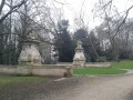
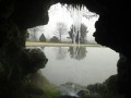
(8) When you reach a junction (with a footbridge over the River Orge on your left and the Georges Carpentier sports hall opposite), head up to the right (Allée Jean Bouille) and then immediately left onto Avenue de la Terrasse Prolongée. Walk past the Lycée Marcel Pagnol. At the junction with Allée Lucie Rivel, head up the stairs on the right until you reach Avenue Botherel, at a place known as la Terrasse. You are now at the foot of the Parc des Grottes. You can walk around the park via the stairs, going up on the right to Boulevard de la Waterfall, and then down the steps on the left.
(9) On leaving the park (Avenue Raspail), turn left and immediately take the path on the right. Follow the path to the right. Take the footbridge over Rue Camille Flammarion.
(10) At the junction of the next two paths, turn right onto Rue de l’Observatoire. At the traffic lights with the RN7, you’ll find yourself in front of the entrance to the Camille Flammarion Observatory. Take the underpass to cross the RN7, then head back up the road opposite via Rue Petit (Juvisy-sur-Orge cemetery on your right).
(11) At the next set of traffic lights – that is, the junction with Boulevard Aristide Briand (Juvisy) – take Avenue Albert Sarrault directly opposite, veering slightly to the left, and carry on straight ahead. After the roundabout, pass the Intermarché supermarket (on your left).
(12) At the junction with Boulevard des Belges, you’ll find yourself opposite the entrance to the Ferme de Champagne. Take the grassy path on the left, which joins Avenue Jean Marsaudon. Walk behind the Aimée Leclerc nursery school (Mail Jean-Baptiste Launay) to reach Avenue des Marronniers. After the car park on your right, you’ll have arrived back at your starting point: the roundabout near the Plateau de Savigny-sur-Orge Cemetery.

 Visorando Member

 Association / Club / Walk leader
 Easy
Easy