Country:
 City:
City:


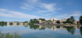

Head to the car park at Camping la Bagatelle, below the Pont Daladier.
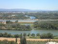
The route is described starting from the banks of the Rhône for the stunning view of Avignon, but you can also set off from other car parks in the city.
(S/E) With your back to the Rhône, head left towards the Pont Daladier and take the steps leading up on your right. Once on the bridge, turn left and head towards the city.
At the end of the bridge, cross at the pedestrian crossings opposite and head towards the ramparts; walk along them for a few metres on the right-hand side until you reach the Porte Crillon. Take Rue Folco de Baroncelli, which runs along the left-hand side of Place Crillon, then turn left onto Rue du Limas. Continue to Place Georges Pompidou, then head back along Rue du Limas and turn right onto Rue Limasset.
Head straight ahead towards the Poterne Georges Pompidou, which allows you to cross the ramparts and emerge outside the city walls. Turn right towards the Pont Saint-Bénézet (1). Look up at the second arch to see the Chapelle Saint-Bénézet, and above it the Chapelle Saint-Nicolas. Pass under the bridge then continue along the pavement to the Porte du Rocher.
Go through the gate to return inside the city walls and follow Rue Ferruce. After the car park, the street becomes pedestrianised and turns left; follow a slight ‘S’ bend (first turn left then right) to reach Rue de la Grande Fusterie. Opposite No. 63, turn left under the archway into Rue Puits de la Reille, continue straight ahead and climb the steps on Rue Pente Rapide, which lead to the Place du Palais des Papes.
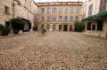
On your left is the Musée du Petit Palais; turn right and walk down the square, admiring the Ancien Hôtel des Monnaies on your right, which stands imposingly opposite the palace entrance. Head left towards the steps leading to the main entrance of the Palais des Papes (2), climb them, then continue straight ahead along the road that runs round the left-hand side of the palace (Montée Jean XXIII). 50 metres further on, turn right to walk past the departmental archives; after a few steps, you’ll reach the forecourt of the Basilica of Notre-Dame des Doms, which overlooks the square.
Opposite the basilica, turn left and go through the entrance gate to the Jardin des Doms; a drinking fountain is just to the left. Do not take the road straight ahead (Montée des Moulins), nor the one furthest to the right, but the path between them – the one that runs to the right of the war memorial and winds its way up to the garden in a zigzag.
Walk round the small lake on the left, pass to the left of the statue of Félix Gras, continue straight ahead, pass the statue of Jean Althen to reach various viewpoints overlooking the Rhône and Villeneuve-lès-Avignon. By following the fence on the left after the statue, you can descend to some esplanades offering fresh perspectives of the Saint-Bénézet Bridge and the Papes’ vineyard.
Turn round and head back to the statue of Jean Althen, go round it to the left and take the steps leading down to the left towards the large esplanade and its orientation table. Continue to the right of this, keeping the low wall on your left, towards the palace. Go down the wide stairs and, after the last step, turn immediately left to find the Escaliers Sainte Anne, which lead down behind the palace.
Pass through two gates, then, after the Théâtre des Doms, take the street on the right which leads to the Cour Maria Casarès at the rear of the Palais des Papes. Head left to pass under the small archway leading to the Verger Urbain V. Cross it and take the cobbled street on the right which leads to the Place de la Mirande.
Head up the small Rue de la Peyrolerie on the right, which winds its way through the rock at the foot of the palace. At the top of this street, turn left onto Rue Jean Villard, which leads to the Place de l’Horloge. At the head of the square stands the Theatre/Opera House, and to its left the Town Hall, topped by the clock tower and its Jacquard figure. Walk down the square on the left and, at the bottom, turn left onto Rue Favard. After the arcades, continue left along Rue de l’Arc de l’Agneau, which leads to Place Saint-Pierre and its eponymous basilica(3).
Pass under the portico to the left of the building to reach Place des Châtaignes. Head left towards Rue de la Banasterie; at number 13 stands the Hôtel de Madon de Châteaublanc. Carry on past the former prison, which has been converted into a museum, to reach the Chapelle des Pénitents Noirs.
Carry on along the street, which, after the postern gate, becomes Rue du Rempart de la Ligne. Opposite the Porte de la Ligne stands the former salt storehouse(4), which has been converted into a theatre. Turn right into Rue Palapharnerie, then right into Place Saint-Joseph and left into Rue des 3 Colombes. Continue for about a hundred metres and turn right onto Rue and Place des Trois Pilats, which leads to Rue Sainte-Catherine.
Follow this road until you reach the Théâtre du Chêne Noir, which stands on the site of the former Church of the Convent of Sainte-Catherine. A little further on, turn left onto Rue Armand de Pontmartin, which leads to Place Carnot. Continue left towards Place Jérusalem and its synagogue; walk past it to reach Place Saint-Jean le Vieux, where the city tower stands; on your right, admire the green wall on the façade of the market halls.
Continue across Place Pie, passing between the bars, to find the small Rue Saint-Jean le Vieux, which starts opposite on the left-hand side of the square. It leads to Place de la Pignotte, at the end of which stands the Chapelle de la Visitation (5), which is in a state of disrepair. Take Rue Paul Saïn on the left; very soon you will see Notre-Dame de la Conversion on your right.
At No. 23bis is an unnamed chapel; continue along the street until you reach Rue and Place du Portail Matheron. Turn right onto Rue de la Carreterie; after 100 metres, you’ll see the Augustinian Bell Tower on your right, the last remaining part of the convent of the same name.
You’ll arrive at Place des Carmes and its covered market; go round it on the left to find, roughly in the middle, the Carmelite Convent and Cloister (6). Return to Rue de la Carreterie and turn left; continue until the next street on the right (Rue Guillaume Puy), which you should take. This leads to Place Louis Pasteur; turn left onto Rue Notre-Dame des 7 Douleurs, where you’ll find the church, though it isn’t very visible.
Carry on along this street until you reach the edge of the ramparts; it then becomes Rue du 58ème RI. Pass through Porte Thiers and continue along the street inside the ramparts for 200 metres. At the second junction, turn right onto Rue des Teinturiers (7), famous for its water wheels. At the junction with Rue Guillaume Puy, you’ll find the house of the IV de Chiffres on the left; continue along Rue des Teinturiers, passing the Chapel of the Grey Penitents and then the bell tower of the Church of the Cordeliers.
Turn left onto Rue des Lices, where, at number 62, you’ll find a former Jesuit convent which now houses the Lycée Saint-Joseph, and a little further on, on the right, the former Aumônerie Générale. Turn right onto Rue Pétramale and enter the square of the same name just after the junction with Rue du Crucifix. (It is possible to continue along Rue Pétramale, but the narrow pavements make this route rather unpleasant).
Cross the square and the Théâtre des Halles to come out onto Rue du Roi René, which you should take to the left. Follow it to Place Saint-Didier, then turn right onto Rue des Fourbisseurs. At the Fork in the road, turn left onto Rue de la Principale until you reach the square of the same name, where the Chapelle des Pénitents Blancs stands.
Turn round, head right onto Rue Piot, then left onto Rue de la Saraillerie, which leads back to Place Saint-Didier. Head to the right to admire the Saint-Didier Collegiate Church (8), retrace your steps and turn right onto Rue Laboureur, which passes in front of the Livrée Ceccano, home to the media library.
Continue along this street until it joins Rue des Trois Faucons; turn right and carry on straight ahead until you reach Place des Corps Saints. Visit the Chapel of Saint-Michel and, continuing on, the Church of the Celestines (9). Turn round and you’ll find Rue Agricol Perdiguier on your left. Opposite number 25, go through the small gate on the right leading into the square and see the Temple of Saint Martial. Continue straight ahead across the square, go round the temple on the right, then exit to rejoin Rue Henry Fabre.
Turn left, walk past the entrance to the temple and head towards Cours Jean Jaurès. Turn right onto Rue de la République until you reach the Lapidary Museum (formerly the Chapel of the Jesuit College). Turn around and retrace your steps, walk past the Tourist Office and turn right onto Boulevard Raspail. At the junction with Rue du Portail Boquier, take a short detour to the left to see the Saint-Louis Novitiate Chapel. Continue along Boulevard Raspail for 100 metres and, just past the contemporary art museum and its art school, turn right onto Rue Saint-Charles.
At No. 4 is the former Saint-Charles Chapel; carry on until you reach Rue Joseph Vernet, which you should take to the left. Continue along this street until you reach the Oratory Chapel, then take a short detour to the right into Rue Saint-Agricol to see the Saint-Agricol Collegiate Church (10).
Return and continue along Rue Joseph Vernet; at number 18, also take a short detour to Place de la Plaisance, passing under a portico, and carry on to the post office. Turn left into the small Rue Mazan, which leads to Place Crillon and its theatre. Turn left towards Porte Crillon, then cross the bridge to return to the car park (S/E).



 a tour of Avignon with lots of places to discover
 Visorando Member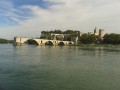
 Moderate