Done: Around the Fontaine de Vaucluse

Mountain bike ride starting from Fontaine-de-Vaucluse; quite challenging as it begins with a 6 km climb on a stony track.
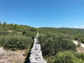
It then offers beautiful views of the Luberon before following the Mur de la Peste.

Details

2469054
Creation:
Last update:
Last review:
  • Mountain biking
    Activity: Mountain biking
  • ↔
    Distance: 8.70 mi
  • ◔
    Duration according to the author: 2 hrs 
  • ▲
    Difficulty: Difficult

  • ⚐
    Back to start: Yes
  • ↗
    Ascent: + 1,781 ft
  • ↘
    Descent: - 1,778 ft

  • ▲
    Highest point: 2,123 ft
  • ▼
    Lowest point: 384 ft
  • ⚐ Country: France
  • ⚐
  • ⚐ City: Fontaine-de-Vaucluse (84800)
  • ⚑
    Start/End: N 43.913439° / E 5.128002°
  • ❏
    IGN map(s): Ref. 3142OT

  • ◶
    Type of surface:
  •  
     
     
     33% Road  34% Byway  33% Path
  • ⇧
    Bike carrying: Not specified
  • ▲
    Difficulty: Not specified
  • Hour-by-hour weather

Description of the route

Head towards Fontaine-de-Vaucluse, following signs for Lagne. On leaving the village, park in the small car park on the left at the ‘Font de l’Oule’ signpost.

(S/E) Turn left onto theGR®®6path, marked in red and white, which leads uphill. Take care on this climb – there are plenty of stones. You’ll reach the Fontaine de l’Oule.

(1) Continue the climb, pushing your bike at times. Carry on northwards, still on theGR®®, until you reach a crossroads with a track.

(2) Turn left heading north along theGR®® to reach another track junction.

(3) Turn right, heading north-west.

(4) Turn right at almost 180° onto this track – this is the Piste de la Pouraque – which becomes rideable and forms part of theGRP®® ‘Sentier Historique du Mur de la Peste’ (Historical Plague Wall Trail), marked in red and yellow. Further down, you’ll reach a cistern.

(5) Continue straight on, passing close to point 2, and stay on this track which runs alongside the Plague Wall. Carry on southwards until you reach a junction in a clearing, where there is another water tank and an information board.

(6) Turn right onto theGR®®6and follow it. You will emerge onto the D100a.

(7) Turn right onto the road to return to the starting car park (S/E).

Waypoints

  1. S/E : mi 0 - alt. 387 ft - Car park at the Font de l’Oule signpost
  2. 1 : mi 1.21 - alt. 1,109 ft - Fontaine de l’Oule
  3. 2 : mi 2.99 - alt. 2,021 ft - Junction, on the left
  4. 3 : mi 3.25 - alt. 2,123 ft - Junction, on the right
  5. 4 : mi 3.74 - alt. 2,083 ft - Track junction, on the right
  6. 5 : mi 4.32 - alt. 2,021 ft - Cistern
  7. 6 : mi 7.45 - alt. 1,027 ft - Water tank junction
  8. 7 : mi 8.33 - alt. 515 ft - D100a, on the right
  9. S/E : mi 8.7 - alt. 384 ft - Car park at the Font de l’Oule signpost

Notes

Remember to take water with you; there are no refreshment points.

Worth a visit

Always be cautious and plan ahead when you're outdoors. Visorando and the author of this route cannot be held responsible for any accidents occurring on this route.

The GR® and PR® markings are the intellectual property of the Fédération Française de Randonnée Pédestre.

Reviews and comments

5 / 5
Based on 1 review

Reliability of the description
5 / 5
Ease of following the route
5 / 5
Route interest
5 / 5
Jean Luc Cervia
Jean Luc Cervia

Overall rating : 5 / 5

Date of your route : Oct 31, 2023
Reliability of the description : ★★★★★ Very good
Ease of following the route : ★★★★★ Very good
Route interest : ★★★★★ Very good
Very busy route : No

A lovely mountain bike ride with superb views of the Luberon and Mont Ventoux.
A steep climb right from the start, with the first 5 kilometres averaging 9 per cent on a very stony track. Gear ratio 30×36–42, and often having to get off and push.
This is followed by a lovely, fast-rolling track across the plateau with some great descents on wide paths.
The last 2 kilometres are very technical, on a narrow track with a steep gradient.
A superb mountain bike ride, but not suitable for beginners

Machine-translated

For more walks, use our search engine .

The GPS track and description are the property of this route's author. Please do not copy them without permission.