On the borders of the Pyrénées-Orientales, Aude and Ariège, starting from Odelló

A circular route leading to the junction of three departments, marked by an engraved stone. A very pleasant walk to the Refuge Oller, which then becomes quite challenging on the ascents that follow. A walk through the heart of the forest and across open plains, overlooking Puyvalador and its lake.

Details

n°15823108
Creation:
Last update:
Last review:
  • Walking
    Activity: Walking
  • ↔
    Distance: 7.29 mi
  • ◔
    Average duration: 5h 15 
  • ▲
    Difficulty: Difficult

  • ⚐
    Back to start: Yes
  • ↗
    Ascent: + 2,211 ft
  • ↘
    Descent: - 2,185 ft

  • ▲
    Highest point: 7,064 ft
  • ▼
    Lowest point: 4,928 ft

Photos

Description of the walk

Reach the hamlet of Odelló from Puyvalador via Réal on the D32E. Car park in the centre of the hamlet.
“The walk is straightforward as far as the Refuge Oller.”

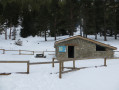
(S/E) Follow theGR® de Pays Tour du Capcir trail. You’ll reach the Abri du Becet shortly after a right-hand bend.

(1) Carry on past the gate (not electrified) used to keep free-roaming cows out. After a left-hand bend, leave the wide track and take a path on the left. Stay on this path until you reach the Oller refuge.

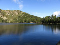
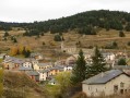
(2) At the Refuge Oller, at an altitude of 1,800 metres, enjoy a magnificent view overlooking Puyvalador and its lake, with the vista stretching as far as the ski slopes at Les Angles. It is from the refuge that the main part of the hike begins.
The path climbs steeply, which is why this walk is classified as difficult. You’ll come to a fork in the path.

(3) At this fork, there are no longer any signs indicating the Tour du Capcir walk. Stay on the oldGRP® route, which heads left, even when the red and yellow markings are no longer visible. These have been painted over in grey. Further on, ignore a path to the right and continue uphill. Shortly afterwards, the path turns eastwards to reach a fork at around 2,150 m.

(4) Turn left and take a barely visible path through the vegetation. At the end of this flat path, facing due north, a wire fence marks the boundary between the departments. Then follow the fence down to the left until you reach the other two fences, marking the boundaries of the three departments. There is a passageway between the fences, which are not electrified.

(5) The marked stone is in Ariège. To head back down, follow the trail in the opposite direction to return to the car park (S/E).

Waypoints

  1. S/E : mi 0 - alt. 4,928 ft - Odelló
  2. 1 : mi 1.22 - alt. 5,180 ft - L’Abri du Becet
  3. 2 : mi 2.35 - alt. 6,001 ft - The Oller Refuge
  4. 3 : mi 2.54 - alt. 6,230 ft - Common junction for out-and-back route
  5. 4 : mi 3.23 - alt. 7,064 ft - Common junction for out-and-back route
  6. 5 : mi 3.64 - alt. 6,962 ft - Marked stone
  7. S/E : mi 7.29 - alt. 4,928 ft - Odelló

Notes

The Abri du Becet and the Refuge Oller provide shelter and basic survival supplies in case of an emergency.

Dogs are allowed on this walk, provided they are kept on a lead.

Always be cautious and plan ahead when you're outdoors. Visorando and the author of this route cannot be held responsible for any accidents occurring on this route.

The GR® and PR® markings are the intellectual property of the Fédération Française de Randonnée Pédestre.

Reviews and comments

4.7 / 5
Based on 1 review

Reliability of the description
5 / 5
Ease of following the route
4 / 5
Route interest
5 / 5
BTD
BTD

Overall rating : 4.7 / 5

Date of your route : Jul 07, 2023
Reliability of the description : ★★★★★ Very good
Ease of following the route : ★★★★☆ Good
Route interest : ★★★★★ Very good
Very busy route : No

A walk starting from Réal, for logistical reasons
A long but interesting route, continuing up to 2,250 m towards Madres (instead of turning back at point 4), a destination which strikes me as far more interesting than stopping halfway up. This brings the total elevation gain to around 1,000 metres, which changes things somewhat. The walk through the different vegetation zones is interesting, and you pass close to an unmanned mountain hut at 1,825 metres, which could serve as a stopover if you want to take your time. Very beautiful views from the ridges.
Total round-trip time from Réal, without dawdling, to the 2,250-metre point = 4 hours for 800 metres of elevation gain.

Machine-translated

Other walks in the area

For more walks, use our search engine .

The GPS track and description are the property of this route's author. Please do not copy them without permission.