The Col Amic and the Ferme-Auberge du Kohlschlag

This short walk offers you the chance to stretch your legs from the Col Amic, situated at an altitude of 828 m and named after a First World War captain, whilst giving you a good excuse (by reservation) to sample the traditional dishes at the Ferme Auberge du Kohlschlag!

Details

33321080
Creation:
Last update:
Last review:
  • Walking
    Activity: Walking
  • ↔
    Distance: 1.85 mi
  • ◔
    Average duration: 1h 05 
  • ▲
    Difficulty: Easy

  • ⚐
    Back to start: Yes
  • ↗
    Ascent: + 315 ft
  • ↘
    Descent: - 318 ft

  • ▲
    Highest point: 2,887 ft
  • ▼
    Lowest point: 2,559 ft

Photos

Description of the walk

The starting point is at Col Amic at the junction of the D13bis and the D431. There are car parks on both sides of the road. There are also picnic tables there.

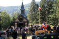
(S/E) Where you see two picnic tables, take the steps leading down and follow the Red Rectangle markings ofthe GR®5towards Vieil Armand. At the bottom of the steps, ignore the path that turns right and head diagonally uphill to the left. At the end of this path, when you cross the departmental road again, leave theGR®5on your right and cross carefully to continue straight on, towards the Sicurani Chapel. From here, follow the Yellow Triangle markings.
After about 150 metres, at the top of this steep slope, you’ll reach a T-junction.

(1) Turn left, still heading towards the Sicurani Chapel. After a rise, ignore the path that continues straight ahead and head down to the right. The path then bends to the left. At the bottom of the path, at a junction with a wider track, cross it and carry on straight ahead to the crossroads about 200 m further on.

(2) Ignore the Yellow Triangle signposting continuing straight ahead and turn sharply left towards Kohlschlag. From here, follow the Blue Triangle signposting. Carry on straight ahead at the next junction. The path passes through a gap in a fence with an information sign about guard dogs. Carry on until you can see the Kohlschlag Farm Inn below.

(3) Walk down to the fence, then turn left and follow it on the left-hand side towards Col Amic and Holzwasen. A few dozen metres further on, go through an opening in the fence to join the tarmac road. Then head uphill to the left. At the top of this road, at a crossroads, leave the Soultz communal forest and the Blue Triangle signposting on your right and head uphill to the left. Just after a final right-hand bend, you’ll reach the Col Amic and your starting point (S/E).

Waypoints

  1. S/E : mi 0 - alt. 2,717 ft - Col Amic
  2. 1 : mi 0.31 - alt. 2,887 ft - Top of the steep climb
  3. 2 : mi 0.74 - alt. 2,631 ft - Turn left towards Kohlschlag
  4. 3 : mi 1.2 - alt. 2,595 ft - Kohschlag Farm Inn
  5. S/E : mi 1.85 - alt. 2,717 ft - Col Amic

Worth a visit

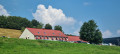
At point (3) is the Kohschlag Farm Inn.

Always be cautious and plan ahead when you're outdoors. Visorando and the author of this route cannot be held responsible for any accidents occurring on this route.

The GR® and PR® markings are the intellectual property of the Fédération Française de Randonnée Pédestre.

Reviews and comments

4.5 / 5
Based on 2 reviews

Reliability of the description
5 / 5
Ease of following the route
4.5 / 5
Route interest
4 / 5
bonpied bonoeil
bonpied bonoeil

Overall rating : 4.7 / 5

Date of your route : Nov 06, 2024
Reliability of the description : ★★★★★ Very good
Ease of following the route : ★★★★★ Very good
Route interest : ★★★★☆ Good
Very busy route : No

A lovely little walk in the sunshine to clear your head

Machine-translated

christrando
christrando

Overall rating : 4.3 / 5

Date of your route : Oct 04, 2023
Reliability of the description : ★★★★★ Very good
Ease of following the route : ★★★★☆ Good
Route interest : ★★★★☆ Good
Very busy route : No

A short, pleasant walk.

Machine-translated

Other walks in the area

For more walks, use our search engine .

The GPS track and description are the property of this route's author. Please do not copy them without permission.