
A return trip from “Zlatni mostove” to “Aleko Hut” in “Витоша” (Vitosha).

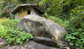
“Витоша” (Vitosha) is the iconic mountain that overlooks the capital, Sofia. From Boyana, about 8 kilometres south of Sofia city centre, take a bus (check for the number) or drive to the place known as the “Golden Bridges” (Златни мостове) in Bulgarian. The route is a round trip with the option to stop for a meal at Aleko (45 mins), provided you arrive there before 3.00 pm. The route, signposted from start to finish, passes through Bor, then across the plateau to the ski resort. After a climb through a forest sheltered from the sun, you’ll reach a plateau covered in meadows and flowers in spring – a sight you won’t forget in a hurry – and a breathtaking 1,000-metre view down over Sofia. Fun is guaranteed, but set off early enough in the morning to be at the car park by 9.00 am and make the most of your day in the mountains; it’s a 30-minute drive from the Boyana neighbourhood to the car park: ‘Златни Мостове – Golden Bridges’ – don’t look for bridges, though; they’re actually huge round or oblong blocks of lava.

Details

105877019
Creation:
Last update:
Last review:
  • Walking
    Activity: Walking
  • ↔
    Distance: 9.89 mi
  • ◔
    Average duration: 6h 05 
  • ▲
    Difficulty: Difficult

  • ⚐
    Back to start: Yes
  • ↗
    Ascent: + 1,739 ft
  • ↘
    Descent: - 1,742 ft

  • ▲
    Highest point: 6,089 ft
  • ▼
    Lowest point: 4,593 ft

Description of the walk

(S/E) From the car park, head north and follow the track until you reach a large playground and picnic area. Leave the road at the bend, continue straight on and take the path that runs alongside the playground on its left. At the top of this path, after 150–200 metres, you’ll come to a crossroads with signposts indicating Bor and the plateau (Плaтото); take the path that turns 90° to the right and climbs steeply.

(1) The slope levels off; walk along the ledge at the level of the hotel for 150 m. Continue to follow the path, which becomes gentler than at the start. The walk becomes more difficult from this point onwards as boulders litter the path and the gradient steepens again. At times, when it has rained, you’ll need to avoid the muddy sections by following small tracks that walkers have carved out to bypass the marshy areas. You’ll reach Bor after crossing the small stream via a brand-new bridge.

(2) You’re almost halfway up the slope to the plateau. The boulders are a bit of a nuisance, and you need to be careful. At the crossroads, head straight ahead, climb for about a hundred metres along a track suitable for vehicles, then turn left onto a path through the forest. You’ll come to a fountain (drinking water).

(4) Follow the path until you reach the edge of the forest. The slope becomes steeper as you head up to the pass (magnificent mountain views).

(5) Turn left towards the pile of rocks; this is Kamen del (the peak above Sofia). Retrace your steps back to the pass.

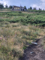
(5) Follow the path to the left and head down the plateau. You’ll reach a mountain hut where you can take shelter in the event of a storm. A very pleasant, gentle 2 km descent. Cross a small ford, then head back up until you come to a gravel track coming up from your right in a hairpin bend. You’ll arrive at an old chairlift.

(6) Take the next path 50 metres to the right, which will lead you straight to the Aleko resort (with a very reasonably priced canteen).

(7) Retrace your steps to return to the starting car park (S/E).

Be careful on the way back at ‘Bor’: after the small bridge behind the building, the path splits into a Fork in the road after 50 metres – take the right-hand fork. It’s hard to remember the details when walking back, especially if the vegetation is lush and overgrown.

Waypoints

  1. S/E : mi 0 - alt. 4,606 ft - Златни Мостове – Golden Bridges
  2. 1 : mi 0.63 - alt. 4,977 ft - Hotel
  3. 2 : mi 1.4 - alt. 5,390 ft - Бор – Bor. Site of a former, disused hotel
  4. 3 : mi 1.59 - alt. 5,459 ft - Drinking water fountain
  5. 4 : mi 2.45 - alt. 6,070 ft - Unnamed pass between “Kamen Del” and “Ушите”.
  6. 5 : mi 2.96 - alt. 6,066 ft - Mountain hut at the foot of Ушите (“the ears”)
  7. 6 : mi 4.39 - alt. 5,951 ft - Dragalefti lift – an old chairlift no longer in use
  8. 7 : mi 5.07 - alt. 5,925 ft - Aleko Hut – Алеко ski resort (restaurant) chairlift
  9. S/E : mi 9.89 - alt. 4,606 ft - Aleko Hut

Notes

A few tips for the walk:

Make sure you’re wearing suitable footwear – no sandals, flip-flops or trainers. Watch your step carefully on the climb up to the pass, as the boulders are uneven, and be especially careful on the way back down, as it’s often on the descent that people fall due to fatigue.

Remember to drink!

For a bite to eat: At the Aleko canteen, I recommend the traditional Balkan drink: a cold Tarator soup made from yoghurt, cucumber, water, garlic, dill, oil and crushed walnuts, served ice-cold as a starter – it’s very refreshing and packed with nutrients to replenish your body. Afterwards, you can try some BOB (pronounced BOP)—a sort of Balkan-style mogette (white beans in a light sauce) from the Balkans – excellent with mountain herbs – which you can enjoy with a kebapche (minced pork and beef) shaped into a long sausage, or keufté (lamb and beef) in the form of a flattened patty made from minced meat seasoned with cumin, salt and pepper, then grilled to perfection.

Returning home: It is advisable to be back by around 4.00 pm in summer, as thunderstorms can break out very quickly in the mountains.

Asking for directions: As few foreigners speak Bulgarian, and Cyrillic signs are difficult to pronounce for the uninitiated, I’d advise you to take a photo of the sign pointing in the direction you’re heading. With even rudimentary English or by using gestures, you’ll be able to make yourself understood.

Worth a visit

In good weather, do make the 400-metre detour to Kamen del (as indicated on the route), the peak above Sofia – the views are unmissable.

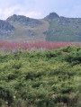
Throughout the descent from the plateau on the way there, look up at the summit to your right – that’s the highest peak of Vitosha. Mushroom-shaped observation and telecommunications buildings stand out against the ridge.

The flora is very varied in May, and there are blueberries in July.

For more walks, use our search engine .

The GPS track and description are the property of this route's author. Please do not copy them without permission.

