Above the Aups via The Peirière

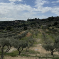
A beautiful walk through various landscapes, olive trees, impressive stone walls, a pine forest, caves and cave chapels.

Technical sheet

129992
Creation:
Last update:
Last review:
  • Walking
    Activity: Walking
  • ↔
    Distance: 7.13 km
  • ◔
    Average duration: 2h 30 
  • ▲
    Difficulty: Easy

  • ⚐
    Return to departure point: Yes
  • ↗
    Vertical gain: + 154 m
  • ↘
    Vertical drop: - 147 m

  • ▲
    Highest point: 651 m
  • ▼
    Lowest point: 508 m

Photos

Description of the walk

Park on Avenue Victor Maria, near the Notre-Dame de la Délivrance chapel. Head to the north-west down this avenue.

(1) After 200 m at the crossing, turn right just before the bridge on the small paved road, Chemin de la Grave. Go due north for about 400 m.

(2) At the fork, take Chemin de la Peirière to to the left and continue on it for about 1 km to the north-east to a crossroads.

(3) Turn right on Chemin de la Croix des Pins, continue on this path past the Estré equestrian shelter.

(4) At a tank, make a sharp right along the path with Yellow markings and follow it.

(5) At the fork, turn left onto the forest track, signposted with a yellow arrow Yellow indicating “Croix des Pins”. Continue south to a junction.

(6) Leave the Yellow markings and head to the left and then turn right in the direction signposted as “Citerne 25m3".

(7) At the tank, take the left path and follow it for 1 km.

(8) In a wide turn, take a small path down to the right at a small cairn indicated by yellow markings on a tree (look out for the the start of the trail). Continue on this narrow path. Then turn right uphill on the path with Yellow markings to the St. Magdalene Caves.
Continue on the trail through the caves and the cave chapel, and a little further to the right the Sainte-Trinité Chapel.
At the end of the paved road opposite follow the trail. Turn left onto Chemin des Devansaux.
Arrive on Avenue Victor Maria.

Waypoints

  1. S/E : km 0 - alt. 516 m - Parking Chapelle Notre-Dame
  2. 1 : km 0.23 - alt. 510 m - Chemin de la Grave
  3. 2 : km 0.6 - alt. 519 m - Bifurcation
  4. 3 : km 1.81 - alt. 614 m - Carrefour
  5. 4 : km 2.93 - alt. 604 m - Tanker
  6. 5 : km 3.46 - alt. 619 m - Fork
  7. 6 : km 4.37 - alt. 642 m - Crossing at hill 643
  8. 7 : km 4.52 - alt. 641 m - Tanker
  9. 8 : km 5.51 - alt. 650 m - Trailhead
  10. S/E : km 7.13 - alt. 516 m - Parking Chapelle Notre-Dame

Practical information

2.5 hours of actual walking, but more like 5 hours accounting for photo stops, snacks and visiting the caves.

Reviews and comments

4.7 / 5
Based on 45 reviews

Reliability of the description
4.8 / 5
Clarity of route map
4.6 / 5
Route interest
4.5 / 5
oponcin
oponcin

Overall rating : 5 / 5

Date of walk : May 01, 2025
Reliability of the description : ★★★★★ Very good
Clarity of route map : ★★★★★ Very good
Route interest : ★★★★★ Very good
Busy trail : No

Take a look at the pictures here:
https://youtu.be/KKUTvD0N6Ik?si=YWquaPz_...

Along the walls and fields of olive trees, then along the forest road to the large caves, including a rock chapel.

Automatically translated

muvar
muvar

Overall rating : 5 / 5

Date of walk : Apr 11, 2025
Reliability of the description : ★★★★★ Very good
Clarity of route map : ★★★★★ Very good
Route interest : ★★★★★ Very good
Busy trail : No

Superb walk, magnificent scenery! Easy route!

Automatically translated

Bmrando
Bmrando
• Last modified:

Overall rating : 5 / 5

Date of walk : Jan 30, 2025
Reliability of the description : ★★★★★ Very good
Clarity of route map : ★★★★★ Very good
Route interest : ★★★★★ Very good
Busy trail : No

Hiking in fine weather. Cold but dry.
Level indicated in line with reality.
Correct indications with the path indicated on the application.
Beautiful viewpoints.
Great times!

Automatically translated

Fibie83
Fibie83

Overall rating : 5 / 5

Date of walk : Feb 17, 2025
Reliability of the description : ★★★★★ Very good
Clarity of route map : ★★★★★ Very good
Route interest : ★★★★★ Very good
Busy trail : No

Easy, varied walk.
Very nice discoveries with the caves and chapels at the end of the walk.

Automatically translated

Ladhak
Ladhak

Hello Dgmick,
I'm sorry that this route didn't meet your expectations.....but I would like to point out that you are the only hiker to have rated this route so badly!
If you walked on tarmac the whole way, you must not have followed the right information...
You're the only one who didn't find the small path to get there.... too bad for you.
I invite you to suggest hikes of your own!
Ladhak

Automatically translated

dgemick
dgemick

Overall rating : 2 / 5

Date of walk : May 31, 2024
Reliability of the description : ★★☆☆☆ Disappointing
Clarity of route map : ★★☆☆☆ Disappointing
Route interest : ★★☆☆☆ Disappointing
Busy trail : No

Only tarmac path, badly signposted. Very disappointing. Indication of caves never found

Automatically translated

xaco83
xaco83

Easy and pleasant walk, great for getting back into the swing of things! Be careful in summer as the start of the hike is sunny!

Automatically translated

Blp69
Blp69
• Last modified:

Overall rating : 5 / 5

Date of walk : Feb 27, 2024
Reliability of the description : ★★★★★ Very good
Clarity of route map : ★★★★★ Very good
Route interest : ★★★★★ Very good
Busy trail : No

A very pleasant walk that ends at the surprising caves. You have to be careful not to miss the path to the right at point 8. The descent from point 8 to the caves is very pleasant!

Automatically translated

xaco83
xaco83

Overall rating : 4.7 / 5

Date of walk : Jan 26, 2024
Reliability of the description : ★★★★★ Very good
Clarity of route map : ★★★★★ Very good
Route interest : ★★★★☆ Good
Busy trail : No

Easy and pleasant walk, great for getting back into the swing of things! Be careful in summer as the start of the hike is sunny!

Automatically translated

SYDO83
SYDO83

Overall rating : 4.3 / 5

Date of walk : Sep 29, 2021
Reliability of the description : ★★★★☆ Good
Clarity of route map : ★★★★☆ Good
Route interest : ★★★★★ Very good
Busy trail : No

As mentioned in previous reviews, park in the town centre car park on your right and then continue up the hill on foot, keeping to the right. However, we took a path (indicated by a wooden sign) too early, so we didn't do 1 to 4 as we arrived at the N°5 fork, but the path was pleasant. Then at N°8 we almost missed the narrow descent to the right, then don't be afraid to go straight on into the undergrowth (we were afraid we'd made a mistake with very few markings) and the arrival at the caves - I say caves because you can't hesitate to go around the rocks to discover other openings and even 2 little swings (hi hi, we're falling back into childhood).
Even though we were afraid at times that we'd regret this walk, the end was worth continuing. In all, 4 hours, including the lunch break and the discovery of the caves and the swing .
Don't hesitate to visit the village and its quiet, clean little streets.

Automatically translated

Ladhak
Ladhak

Thank you for enjoying the walk, it's true that parking the car is not easy, but leaving from the various car parks and with a map of Aups, it's not a problem to find the start...

Automatically translated

RENAUD Alain
RENAUD Alain

Overall rating : 5 / 5

Date of walk : May 02, 2021
Reliability of the description : ★★★★★ Very good
Clarity of route map : ★★★★★ Very good
Route interest : ★★★★★ Very good
Busy trail : No

Nice little hike where the first pleasant part to the Gite de l'Estrée is on tarmac road.
The second part is superb in undergrowth and a very beautiful final Chapels and Caves.
One important point: It is impossible to park in the place indicated for the start unless there is a miracle.
On the other hand, there are car parks in Aups, which extends the route by a visit to the village.

Automatically translated

dragoniere
dragoniere

Overall rating : 4.7 / 5

Date of walk : Feb 27, 2021
Reliability of the description : ★★★★★ Very good
Clarity of route map : ★★★★☆ Good
Route interest : ★★★★★ Very good
Busy trail : No

Quiet little hike, varied scenery, very good description, nice spots, perfect. 4 hours wandering around.
Thanks to Ladhak:

Automatically translated

Ladhak
Ladhak

Hello,
Thank you for enjoying the hike and for leaving 1 short message.
Concerning n°1, for me the green barrier appears only to protect the passage of water in times of heavy storm and therefore seen like that the path is before ....but everyone interprets the definition of a bridge !!!! In my description I mentioned the path to take, Chemin de la Grave ....
As far as n° 8 is concerned, you can probably take 1 other route, it's up to you !!!
Have a nice day!

Automatically translated

yan1603
yan1603

Overall rating : 4.3 / 5

Date of walk : Feb 27, 2021
Reliability of the description : ★★★☆☆ Average
Clarity of route map : ★★★★★ Very good
Route interest : ★★★★★ Very good
Busy trail : No

Lovely walk,some fine views of the Coudon,the Ste Victoire,the Béssillon etc... Nice rocks,caves and troglodyte chapel.very easy.However:
N°1 do not turn right before the bridge (green barrier) but AFTER!
N+8 In a wide bend, it would be better to write "in a wide right-hand bend, at the small cairn".
A rather imposing cairn on the right (in front of a high voltage pylon), is in a bend on the left (just before N°8) and you can also take this path (alternative). Be careful, there are 2 paths: leave the one on the right and take the one just under the track.

Automatically translated

Other walks in the area

For more walks, use our search engine .

The GPS track and description are the property of the author. Do not copy them without permission.