Exploring Monte Ceva

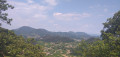
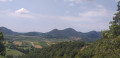
The Monte Ceva–Spinefrasse area is one of the most interesting in the Euganean Hills of Veneto. It resembles a semi-circular amphitheatre of hills, whose peaks do not exceed 255 m in height. Its distinctive geological composition, of volcanic origin, is what makes it unique; combined with the region’s microclimate, this has allowed a natural oasis to form.

Details

n°11519335
Creation:
Last update:
Last review:
  • Walking
    Activity: Walking
  • ↔
    Distance: 8.30 mi
  • ◔
    Average duration: 5h 55 
  • ▲
    Difficulty: Average

  • ⚐
    Back to start: Yes
  • ↗
    Ascent: + 2,402 ft
  • ↘
    Descent: - 2,411 ft

  • ▲
    Highest point: 768 ft
  • ▼
    Lowest point: 26 ft

Photos

Description of the walk

Car park near the Museo Internazionale del Vetro d’Arte e delle Terme (International Museum of Glass Art and Spas) on Via Enrico Fermi in Montegrotto Terme.

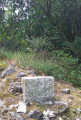
(S/E) With your back to the road, take the path leading up through the grass, as close as possible to the museum, to reach the picnic tables under the trees. Take the path to the left of the Nordic walking sign. Cross the bridge and follow the winding path up to a Fork in the road (not shown on the map) with a small memorial stone.

(1) Turn left. At the top, continue to the left and then ignore the path on your right. At the next fork in the road, continue to the right. Pass through a clearing. At the fork near an abandoned vineyard, turn left, entering the woodland until you reach another fork (not shown on the map).

(2) Keep to your left and head downhill. Be careful: a stream runs alongside the path. At the junction, at the entrance to an old quarry, continue to the left towards the wooden railing. The path becomes a road; carry on downhill. At the house, turn right. At the junction, go straight on along the track marked by a road sign and a chain at the entrance. Walk for about 350 m and look out for a path on your right (not shown on the map).

(3) Take this path uphill through the trees. At the top, turn left. Walk down the path for 500 m and, just before a house, take the hairpin bend on your right. Walk uphill, leave the woods, pass some olive trees, then, in front of a house and at the junction, turn right. Walk past some vineyards and enter the woodland. Walk uphill, leave the woodland again and walk alongside another vineyard until you reach the middle of it.

(4) Turn right and cross the vineyard. Enter the woodland again. Then emerge from under the trees, ignoring the paths on your right (not shown on the map), and walk to the crossroads. View of Monte Ceva and its cross: that’s where you’ll be heading shortly. Take the road leading downhill on your left. Then keep to your right and go through the gate at the side of the portico.

(5) Walk down the road and, at the junction, cross carefully to continue straight on along Via Monte Ceva (a dead-end road). Walk along this road, against the flow of traffic, until you reach a wayside shrine on your left. Take the path running behind it. Walk uphill following the main path until you reach the junction with an information board.

(6) Turn left. Head uphill, keeping to your left, until you reach the cross at the top of Monte Ceva. 360° view. With your back to the cross, take the path heading south-east. At the Fork in the road by the rocks with small cacti, take the path on the right. This will take you round the ridges on the right. The descent is secured with ropes in places.

(7) At the T-junction, turn left. Then keep to your right. Descend over the bleached lava and walk to a path with a railing.

(8) Take this path heading to the right, cross a meadow, enter the woodland and turn right at the T-junction. Further on, go round the gate and pass an abandoned house. Walk along the main path until you have to go round another gate. Turn right and follow the gravel path for 700 m, until you reach the information boards and a wooden gate on your right.

(9) Take the path on the right and, at the junction, take the sunken path, ignoring the path on the right. At the clearing, continue to the left. At the next fork, keep to the left. The path turns left. At the gate, continue to the right. At the large clearing with picnic tables, turn right and follow the path that continues past the tables. Climb up through the woodland and, further up, you’ll find a viewpoint overlooking Battaglia. Continue to a T-junction.

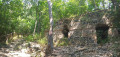
(10) Head up to the right and begin the long and challenging climb back down. Pass the monastery ruins. Keep to the right and take the path with the log railing. At the three-way junction, turn left and then keep to the left. Walk out into the open and continue along the path. Pass a signpost marking Monte Gnocozzo.

(11) Continue along the main path, ignoring the path on the right a little further on. Stay on the ridge path. Then ignore the two paths on your right (not shown on the map) and continue the climb. At the top, continue to the left. Follow the path until you reach the information board from the outward journey.

(6) Head back down the path to the left of the sign until you reach the wayside shrine. At the road, turn right. At the junction, cross carefully and take Via Monte Nero (a dead-end road) straight ahead.

(5) Walk up the road towards “La Bettola”, ignoring the barrier you passed on the way there. Continue uphill and walk past a wayside cross. After the house, opposite the wayside cross, leave the path on your right. Then ignore the paths further on to your left. Walk between the restaurant and the terrace, until you reach the corner of the building.

(12) Turn right behind the bar. Head downhill, keeping to your left.

(2) At the junction, turn left. Go uphill and then keep to your right. Come out into the open and walk alongside the vineyards. Join a path coming out of the woods and continue to the right. At the Fork in the road, leave the route you took on the way there and turn left, until you reach a wooden railing.

(13) Head downhill to the right and, at the bottom, continue to the right. The path curves sharply to the left. Cross an open area and you’ll come to a bench.

(14) Take the path next to the bench, heading to the right. At the bottom, turn right and head downhill. At the stony track, cross diagonally to the left and take the path opposite. Head downhill towards the gate near the museum. Go through it, walk past the museum and then return to the car park (S/E).

Waypoints

  1. S/E : mi 0 - alt. 43 ft - Museum car park
  2. 1 : mi 0.27 - alt. 302 ft - Fork in the road with a memorial stone
  3. 2 : mi 0.62 - alt. 394 ft - Fork
  4. 3 : mi 1.06 - alt. 56 ft - Path
  5. 4 : mi 2.01 - alt. 472 ft - Vineyard
  6. 5 : mi 2.37 - alt. 387 ft - Gate
  7. 6 : mi 2.93 - alt. 656 ft - Information board
  8. 7 : mi 3.45 - alt. 305 ft - T-junction
  9. 8 : mi 3.56 - alt. 151 ft - Path on the right
  10. 9 : mi 4.41 - alt. 33 ft - Information boards
  11. 10 : mi 4.8 - alt. 115 ft - Junction after the viewpoint
  12. 11 : mi 5.67 - alt. 505 ft - Monte Gnoccozzo marker
  13. 12 : mi 7.32 - alt. 446 ft - Restaurant: La Bettola del Refosco
  14. 13 : mi 7.78 - alt. 351 ft - Railing
  15. 14 : mi 8.01 - alt. 233 ft - Bench
  16. S/E : mi 8.3 - alt. 43 ft - Museum car park

Notes

It is recommended that you have the GPX track or read the description carefully, as there are many paths on the ground that do not appear on the map, and vice versa.

There is no drinking water along the route but, depending on the time of day, you can quench your thirst and have a bite to eat at (12) at the La Bettola del Refosco restaurant.

Benches: at (6), before (10), at the Via Monte Nero wayside shrine and at (14).

Picnic tables after (9) and at (S/E).

Between (6) and (7). A high and tricky section on the descent from Monte Ceva for inexperienced walkers or those with a fear of heights. Cables are in place but may be poorly positioned.

At (10) the start of a long and demanding climb until you rejoin the (6) not far from Monte Ceva

Worth a visit

During

Colli Euganei: The Euganean Hills are an isolated group of rugged hills, situated south-west of Padua, in the province of the same name and the Veneto region of Italy. Monte Cerva and Monte Spinefrasse form part of this range. Why ‘Euganean’? Because this was the name of the people who inhabited the region before the arrival of the Veneti. They cover an area of 18,700 ha and reach a height of 601 m at Monte Venda.

Oratory at the foot of Monte Cerva.

Ruins of the Monastero Santa Maria delle Croci: possibly founded by the Lords of Carrara in the 13th century, it was one of the first monasteries to promote the Albi movement of Padua, to whose congregation it belonged from the time of its foundation in 1224.

Reviews and comments

4.3 / 5
Based on 2 reviews

Reliability of the description
4.5 / 5
Ease of following the route
Non utilisé
Route interest
4 / 5
rocarando
rocarando

Overall rating : 5 / 5

Date of your route : Jun 09, 2025
Reliability of the description : ★★★★★ Very good
Ease of following the route : Not used / Not applicable
Route interest : Not used / Not applicable
Very busy route : Yes

Great app that I use in addition to iGN Rando.

Machine-translated

lazzerini
lazzerini

Re,

As for the Padua area, I must say I’d found quite a few walks in the Euganean Hills (of which Monte Ceva is a part), but as I didn’t have a car to hand, I wasn’t able to go and explore the area around Arqua Petrarca and Teolo. So it is possible to go on a hiking holiday in that area, but it’s true that it isn’t the first place hikers would think of visiting…

I look forward to reading about other hikes in Belgium or Luxembourg… perhaps.

Kind regards

Machine-translated

mountainbike
mountainbike

Hello Carla,

Yes, I imagine there aren’t many French-speaking walkers who’ll be exploring these hills. With Padua and Venice nearby, it isn’t really a walking region, strictly speaking.
In any case, the weather was really lovely on 11 October.
I’m Belgian too, originally from the Gaume region, and I see you’ve posted lots of walks in the south of Belgium and Luxembourg, which I know quite well having explored them mainly by bike. It makes me want to take inspiration from them for my next walks.
Best wishes
Pierre

Machine-translated

lazzerini
lazzerini

Hello mountainbike,

thank you for completing this ride; I must admit I didn’t expect it to be ridden before next summer…
and yet…
I went up to (3) because there were lots of mountain bikes on the path and that trail ‘called out to me’. It’s true that the top section isn’t the best part of the ride, but as I didn’t go all the way to the end of the path, I didn’t know if it got any better… especially given the number of bikes I came across.
Between (6) and (7): I’ll note this exposed section in the practical information. I’m not comfortable with heights and I didn’t really have any difficulty, but… it’s worth mentioning.
I didn’t mention Monte Spinefrasse apart from in the summary section of the walk, as there really isn’t anything specific to see there. On the map, you can tell when you’re passing it – that’s all.

At (5), on the way back I suppose, I’m referring to the house in front of the wayside shrine. As that seems too vague, I’ll rephrase this bit.

You’re right about how demanding this climb is, on the return journey from (10), but as I’d done it in early July, I’d put it down to the heat.

In any case, thank you for all these details and your impressions.

Machine-translated

mountainbike
mountainbike

Overall rating : 4 / 5

Date of your route : Oct 11, 2021
Reliability of the description : ★★★★☆ Good
Ease of following the route : Not used / Not applicable
Route interest : ★★★★☆ Good
Very busy route : No

A very demanding route. I completed it over 14.5 km with 820 m of elevation gain (Strava). At the start, up to the railing (2), simply follow the white-green-white markings, sometimes accompanied by the letters ET. Point 3: the path leading uphill to the right is of little interest at its end: a water catchment and rubbish of all kinds. After that, it’s best to take the path level with the house. That’s where the route becomes truly interesting and challenging. At point 6, it should be noted that the descent is dangerous, especially for inexperienced walkers. The ropes are poorly positioned and already worn in places. Point 10: a very demanding and very long climb, which took me to Monte Spinefrasse, which is not mentioned in the route description (there is absolutely nothing to see there). I wondered if I was on the right path, but by carrying on (the climb remained very demanding) I did indeed reach the Bivio dei Turri (almost back at Monte Ceva). Point 5: between the wayside shrine and the house (which house is it? There are several houses in that spot), you actually need to follow the sign for Bettola, which is the name of the café-restaurant.
A very peaceful route, except at the start due to the traffic noise. Superb view from Monte Ceva

Machine-translated

For more walks, use our search engine .

The GPS track and description are the property of this route's author. Please do not copy them without permission.