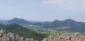
Villa Draghi

Come and walk on Monte Alto, Monte Trevisan and Monte Alto dea Soiva, hills forming part of the Euganean Hills in Veneto, and finish at Villa Draghi, which has become the symbol of Montegrotto Terme.

Details

n°11426311
Creation:
Last update:
Last review:
  • Walking
    Activity: Walking
  • ↔
    Distance: 4.12 mi
  • ◔
    Average duration: 3h 05 
  • ▲
    Difficulty: Moderate

  • ⚐
    Back to start: Yes
  • ↗
    Ascent: + 1,339 ft
  • ↘
    Descent: - 1,312 ft

  • ▲
    Highest point: 627 ft
  • ▼
    Lowest point: 43 ft

Photos

Description of the walk

Car park near the Museo Internazionale del Vetro d’Arte e delle Terme (International Museum of Glass Art and Spas) on Via Enrico Fermi in Montegrotto Terme.

Signposting: White-Green-White flags

(D//A) Take the path leading uphill across the lawn, closest to the museum, to reach the picnic tables under the trees on the left. Take the path to the left of the Nordic walking sign. Cross the bridge and follow the winding path uphill to a Fork in the road (not shown on the map) with a small memorial stone.

(1) Turn left. At the top, continue left and ignore the path on your right. At the fork in the road, continue left. Pass through a clearing. At the fork near an abandoned vineyard, turn left. Head into the woodland until you reach a fork (not shown on the map).

(2) Carry on to the left. Head downhill. At another Fork in the road, turn right and head uphill. At the junction behind the restaurant, turn left and walk along the road. In the bend, after the wooden safety rail, turn right. Climb Monte Trevisan (alternative route).

(3) Pass a path on your left and carry on straight ahead. At the multi-way junction, go straight ahead, to the left of the bench. Atthe second multi-way junction, turn left. The path becomes a road. In front of the house, turn right onto a grassy track. The signposting ends here.

No signposting

Walk alongside the olive trees. You’ll come to a road; turn right. Walk along the quiet road for 250 m until you reach a path on the right. The signposting reappears.

Markings: White-Green-White flag

Head uphill, ignore a path branching off to the right (not shown on the map) and carry on straight ahead. At the fork in the road (not shown on the map), take the left-hand path. The path bends and descends. Walk out into the open and continue downhill. At the multi-way junction, carry on straight ahead. At the T-junction, turn left until you reach a fork in the road.

(4) Turn left and, at the next T-junction, continue to the right. Ignore all the paths on either side until you reach a Fork in the road near a building overgrown with vegetation.

(5) Carry on to the left; at the fork in the road, carry on to the right. Walk alongside the vineyards, then continue until you reach a three-way junction.

(6) Turn left. At the next junction, continue to the left. Keep to the left and walk out into the open. At the T-junction, continue to the right. At the next junction, turn left and then take the path up the embankment to enjoy a view of Villa Draghi. Head back down to rejoin the path to the gate.

(7) Turn right before the gate. Stay on the level path. At the Fork in the road, keep to the left. At the stony track, turn right and head downhill. Return to the picnic tables at the start and head back down to the car park (S/E).

Waypoints

  1. S/E : mi 0 - alt. 43 ft - Car park near the Museum
  2. 1 : mi 0.18 - alt. 299 ft - Fork in the road with a memorial stone
  3. 2 : mi 0.52 - alt. 394 ft - Fork
  4. 3 : mi 1.04 - alt. 486 ft - Path turning back to the left
  5. 4 : mi 2.45 - alt. 377 ft - Fork
  6. 5 : mi 2.66 - alt. 315 ft - Fork in the road, building, vegetation
  7. 6 : mi 3.38 - alt. 390 ft - Three-way junction
  8. 7 : mi 3.82 - alt. 194 ft - Grid
  9. S/E : mi 4.12 - alt. 43 ft - Car park near the Museum

Notes

Markings: occasionally, a piece of barrier tape in the branches helps you find your way.

There is no drinking water along the route but, depending on the time of day, you can have a drink and a bite to eat after (2) at the La Bettola del Refosco restaurant.

Bench: at the multi-way junction after the climb up Monte Trevisan, before Villa Draghi after (6)

It is recommended that you have the GPX track or read the description carefully, as there are many paths on the ground that do not appear on the map, and vice versa.

Worth a visit

During
Colli Euganei: the Euganean Hills, an isolated range of rugged hills situated south-west of Padua in the province of the same name and in the Veneto region of Italy

Villa Draghi: a stately home now regarded as part of the local cultural heritage. The building, which dates from the 18th century, was owned by various families from whom it inherited its unusual name. It is a unique example of eclectic architecture, drawing on both the Venetian lagoon and Oriental styles, with typically medieval elements. Around the villa lie the remains of what was once the historic garden. Under renovation in July 2021.

Reviews and comments

5 / 5
Based on 1 review

Reliability of the description
5 / 5
Ease of following the route
5 / 5
Route interest
5 / 5
rocarando
rocarando

Overall rating : 5 / 5

Date of your route : Oct 01, 1958
Reliability of the description : ★★★★★ Very good
Ease of following the route : ★★★★★ Very good
Route interest : ★★★★★ Very good
Very busy route : Yes

After a few days of practising to get to grips with the tool, I can’t do without it now...
Stevenson,
Tour de l’Aubrac,
ST Guilhem
WELL DONE

Machine-translated

For more walks, use our search engine .

The GPS track and description are the property of this route's author. Please do not copy them without permission.