Country:
 City:
City:


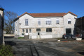
The car park is located at car park no. 2 of the spa centre (beside the D134). Please note that this car park is closed at night from 8 pm.
(S/E) From the car park, take Avenue Winston Churchill downhill towards the level crossing. Just before the crossing, turn right, cross the avenue carefully, and enter the Jonzac spa centre. Walk along the pond and, after passing the spa centre’s reception, head to the staff car park at the far end, then take the small path on the other side of the hedge to reach the Maison de l’Énergie. Make your way to Route de Bellevue (D134E3), walk down it and cross the railway line carefully at the level crossing.
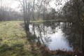
(1) Turn left onto the D134E3 (Boulevard Adrien Barthélémy) and follow it carefully for about 120 metres. Turn right onto the path heading north, running alongside a vineyard on your right-hand side. The path then runs alongside a pond on your left-hand side, at the edge of which there is a fitness trail. Turn left onto the path just before the end of the pond, pass point 16 of the fitness trail, and follow the pond’s edge round to the north until you reach a path that runs between this pond and a smaller one. Turn right to immediately reach a road, and follow it to the left for about fifty metres.
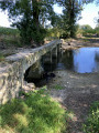
(2) Turn right just after some buildings and, when you reach the banks of the Seugne, take the path on the left that runs alongside it until you can cross the river via a small bridge. Turn left again to continue along the Seugne, which is now on your left. Further on, the path turns right to run alongside a small stream (canal). Carry on to the bridge on the left.
(3) Cross the stream (canal) via the bridge, then turn immediately right onto the path which, shortly afterwards, joins the Seugne on your left and follows it. Head to the next bridge to cross the river, then follow the path which runs alongside it on your right, before veering slightly away from it. When the path turns left towards the campsite, carry straight on to cross the Seugne again via a bridge, and take the Chemin de l’Abreuvoir.
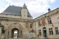
(4) At the end of a short wooded area, near the first houses, the path becomes a street that climbs towards the Place du Château, taking a right-angle bend to the left. Walk round the square, past the Tourist Office, to reach the Place Fillaudeau, on the corner of Rue du Four.
(5) Walk along the western side of this square, then turn left into Rue Taillefer, which heads north-west. Take the first right onto Place du 8 Mai 1945 and continue straight on until you reach Boulevard René Gautret (D28). Move about ten metres to the left and cross the road carefully.
(6) Continue along the Petite Rue, which runs alongside the cemetery, slightly uphill, and joins the D28E1 shortly afterwards. Follow the D28E1 carefully, continuing uphill until you reach the track on the right which heads north-east between two vineyard plots, at the bend to the left, just after the Domaine de la Pérauderie.
(7) Take this path and, at the highest point, turn right to climb slightly towards the east. Just before a pond on the right, turn right onto the path leading to the hamlet of La Terrière. At the crossroads near the hamlet, turn left onto the farm track which joins the Archiac road (D699). Cross it carefully, and continue straight ahead along the farm track. Carry on straight until you reach a small road near the hamlet of Chez Vinet. Turn right and follow the road carefully until you reach the first track on the left, at the edge of the Bois de la Sablière.
(8) Take the track branching off to the left, running alongside the small wood, then enter the wood and follow it until you reach a very shaded track. Turn left and follow the track through the Bois de la Sablière. Then, at the junction on the edge of the wood, turn right and head for the road known as the Bois du Fief des Chailles, and cross the hamlet.
(9) Turn left onto the shaded path heading north-east, which climbs towards some vineyard plots and winds its way between them. Follow it to a T-junction. Turn right, cross the dirt track known as ‘Chez Piaud’, and continue straight ahead, downhill, to the Route de Barbezieux (D2). Cross it carefully, continue along the small road opposite – which is set back about ten metres to the left – and reach a track on the right, about fifty metres before the Route de Chez Marchand.
(10) Turn right onto the track. Follow this path and, just before a sharp left-hand bend, at the corner of a vineyard plot, turn right onto a farm track that runs alongside an intermittent stream, between two small woods. After about two hundred metres, between the two woods, turn right onto the path that enters the woods, heading uphill towards La Morpannerie.
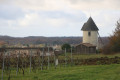
(11) On reaching the plateau, as you emerge from the woodland, join the small road leading to the hamlet of La Morpannerie, and follow it, turning left towards the west. Further on, the road passes the driveway to the Château de la Dîmèrie on the left. Carry on straight ahead. At the junction with the Route du Fief de Chaille, continue to the left, passing a few houses on your left-hand side. Shortly after the last house, turn left to cross the ditch running alongside the road via a small bridge, and take the path heading south between the vineyards on your right and a garden on your left. A little further on, the path turns to the right and heads towards the Cluzelet Windmill.
(12) The Cluzelet mill overlooks the hillside , offering a remarkable panoramic view of the town of Jonzac and the valley. Continue along the path furthest to the left, which descends the hillside towards the south-west. Just before reaching the D142, turn left onto the road that runs alongside a woodland on your left and passes two properties on the right, before reaching Rue du Bois de Chez Pinaud. Turn right and continue to the D142.
(13) Follow the D142, turning left and walking for about a hundred metres, using the wide pavement that runs past the Jonzac Conference Centre. In front of the building, cross the D142 with great care, using the pedestrian crossing. Take the footpath that branches off to the right in front of a house. The path winds its way down towards the Seugne. Keep all the buildings on your right as you pass them. Cross the river via a small bridge, then turn left immediately afterwards. The path then runs alongside the Seugne on your left. Continue until you reach a wooded area on the opposite bank. Pass two small branches of the river and cross a sort of small island before crossing another branch of the Seugne, which flows intermittently. Continue along the path as it moves away from the river; it will soon reach a crossroads. Turn left and continue until you reach a right-hand bend.
(14) Turn left onto a faint path. If necessary, cross the fences set up to keep the horses from the nearby riding centre on the other path. Join a well-maintained white track between two vineyard plots a little further south. Continue along this track to return to the D134E3.
(1) Carefully follow this road southwards , cross the level crossing, and follow the small road branching off to the left immediately after the railway line. Pass the hamlet of Migron, and continue along the road which curves to the right, heading south. Just before joining the D28, turn right onto a barely marked track to reach the edge of a small wood and a better-defined farm track.
(15) Turn right and follow the edge of the woodland on your left to reach the road leading to the hamlet of La Petite Mouillère. Follow it north-west to reach the D134. Turn right carefully, walking along the verge of the road until you reach the roundabout. Walk down Boulevard Winston Churchill until you reach the car park on your left (S/E).


 Visorando Member
 Easy
Easy