Country:
 City:
City:




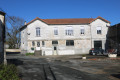
The car park is located at Place Saint Exupéry or the adjacent Rue du Lycée.
(S/E) Leave the car park heading towards the Lycée Jean Hyppolite. Walk along its left-hand side, on the western side. At its northern end, there are toilets on the right. Continue straight on towards the Seugne, passing the campsite on your left. The path turns to the right. Take the bridge to cross the Seugne and continue towards Place du Château.
(1) Before reaching the houses lining the square, turn left onto a path that runs along the southern side of the houses, leading to the Medieval Garden. About 120 metres further on, turn right into a narrow alley which opens out at the junction of Place du Château and Rue James Sclafer. Turn left to follow Rue James Sclafer, which runs alongside Place de la République on your right. Turn right to cross the western side of Place de la République and take Rue du Tourniquet on your left.
(2) Turn right onto Rue Sadi Carnot. After about 150 metres, at a pedestrian crossing, take the narrow medieval Rue de Champagnac on the right. Follow it until it opens out onto Place du Château next to the Tourist Office. There are some beautiful old houses all along this street. Head to the Place du Château in front of the majestic entrance with its two towers.
(3) Turn left onto Rue du Château, which crosses the square, passing between the two towers. Admire the architecture of the château, now occupied by Jonzac Town Hall on the left-hand side and the District Sub-Prefecture on the right-hand side.
(4) Turn right onto Rue du Château d’Eau, which slopes downwards. The route now follows the GR®360 – GRP® de Saintonge. At the bottom of the slope, at the three-way junction, take Rue Emon on the left. At the end of this street, turn right onto Avenue Joffre. About fifty metres further on, cross Boulevard René Gautret carefully (there is a pedestrian crossing on the right) and continue straight ahead uphill along Rue du Bourg Nouveau.
(5) After about 150 metres, turn right onto a path that heads through a wooded area. Follow it until you reach the Route du Bois du Fief des Chailles. Turn right and follow this road downhill for a good 60 metres or so.
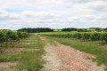
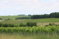
(6) At the bend in the road, take a path leading off to the left towards the area known as Fief de la Chaille. The path then climbs the hillside through the vineyards. At the next T-junction, turn right and, after about one hundred metres, turn left onto a well-maintained farm track. Follow it to the hamlet known as Chez Piaud.
(7) At the crossroads in the centre of the hamlet, take the street on the right and then immediately the one on the left to reach Rue du Bourg Nouveau. Turn right and follow this road eastwards. Pass the Chemin de Chez Garnier on your left and continue straight on. You will then cross an intermittent stream at the path known as L’Hôpital on your left.
(8) Two hundred metres further on, leave the GR®360 by turning right onto a path that runs alongside a vineyard on the right and a field on the left; this path is two hundred metres before the road leading to the hamlet known as Les Maisons Neuves. The path climbs towards a wood in the Montalin area. Go round the wood on the right, staying on the main path. About 100 metres past the woodland, turn left onto a path heading towards the D2 road.
(9) Follow it to the right to reach the lay-by on the south side of the road, some forty metres further on, which requires you to cross the D2 road with care. Pass the road known as Chemin de Chez Marchand on your left, then turn left onto the farm track about thirty metres further on. Just before the woodland, turn right and follow the edge of the woodland. Cross an intermittent stream and immediately turn left to enter a clearing between two woods. About one hundred and fifty metres further on, take the path on the right which climbs into the woods towards La Morpannerie. When you reach the edge of the woods at the top of the hill, turn right onto a farm track which leads to the hamlet of La Morpannerie.
(10) Follow the road westwards. Pass the driveway leading to the Château de la Dimerie. Continue straight on through the hamlet of Casse Coie, then, after the last house, turn left onto a farm track heading towards the vineyards, initially running alongside the property’s garden on your left. The track bends as it reaches the edge of a small wood. Follow it to the Cluzelet Windmill. There is a lovely view of Jonzac and the surrounding area from the windmill site.
(11) Continue along the downhill track that runs alongside the woodland on your left, heading towards Les Terres du Moulin.
(12) Cross the D142 road with care and continue straight ahead into Rue de Beaulieu. After 150 metres of a gentle descent, turn right to reach the Antilles car park (at the motorhome parking area). Keep to the left of the car park to head towards Chez Bret, where there is a watermill.
(13) Immediately after, at the crossroads, take the path leading straight ahead towards a small pond. Go round it on the right for about 100 metres before turning right onto a good path, then left towards the Seugne. Cross the first branch of the Seugne, then continue along the boardwalk which winds its way towards the second branch of the Seugne. Cross it and climb the zigzagging staircase towards Rue de Guiffier.
(14) Turn right to follow Rue de Guiffier back to Rue du Lycée and Place Saint Exupéry, where the car park is located (S/E).
 Visorando Member

 Moderate