Cycling in the Mille Étangs area

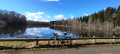
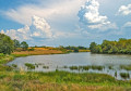
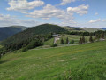
Here you’ll discover: quirky huts, numerous ponds, a monumental cross, scattered hamlets and typical farms, a few viewpoints over the surrounding countryside (Planche des Belles Filles, Ballon de Servance, Plateau des Mille Étangs…) and much more besides!
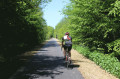
Starting from Mélisey, this circular route follows the small roads that criss-cross the Plateau des Mille Étangs. There’s little traffic and few difficulties, but an e-bike will save you a fair bit of effort on the area’s sometimes steep slopes.

Details

n°34957545
Creation:
Last update:
Last review:
  • Road cycling
    Activity: Road cycling
  • ↔
    Distance: 28.58 mi
  • ◔
    Duration according to the author: 3 hrs 
  • ▲
    Difficulty: Moderate

  • ⚐
    Back to start: Yes
  • ↗
    Ascent: + 1,749 ft
  • ↘
    Descent: - 1,726 ft

  • ▲
    Highest point: 2,011 ft
  • ▼
    Lowest point: 1,030 ft

Description of the route

Start from the car park at the Mélisey Tourist Office.

(S/E) With your back to the Tourist Office, turn left, heading south-west.

(1) At the Stop sign, turn right, continue for about 300 metres and you’ll reach a four-way junction.

(2) To avoid some of the long straight stretch of road through Mélisey and its heavy traffic, turn left onto Route du Stade. Walk past the secondary school and the Mélisey stadium, then continue to the ‘Stop’ sign on the D486.

(3) Turn right and carry on to the roundabout.

(4) Take the D74 to the right, towards Lantenot and Saint-Sauveur, then carry on straight on until you reach Lantenot.

(5) At the Stop sign, follow the D18 to the right, towards Luxeuil-les-Bains, and carry on until you reach the outskirts of Rignovelle.

(6) Turn right onto the D18 towards Magnivray, then drive straight through the village.

(7) Just after a sharp bend on the right, turn right onto Rue de la Corbière, towards La Corbière. Carry on straight ahead until you reach the D137.

(8) At the Stop sign, turn left, then immediately right onto Rue du Bois de la Grange, towards La Proiselière-et-Langle. Drive past a lovely spot with some unusual huts by a small pond. After a fairly steep descent, you’ll reach a junction with a wayside cross on your right, at the end of Route du Ruisseau de la Goutte (D311).

(9) Turn right and continue for 200 metres until you reach a fork with a bridge on the left.

(10) Turn left onto the D139, towards Amage, and cross the bridge over the Breuchin. Continue straight on until you reach the D6.

(11) Turn left towards Raddon, pass through the village of Amage and reach the Town Hall.

(12) Turn right onto Rue des Champs Pey, towards Le Creux Chêne. You will then begin a long climb up to Le Petit Rang, then Les Grillots and Les Fahys. Descend carefully, fairly quickly, through some sharp bends. You’ll come to a tight right-hand bend at a junction.

(13) Turn sharply right towards Breuchot, and continue straight on until you reach a multi-way junction (cross) at Freugevin, after the hamlet of La Glayère.

(14) Follow the road on the left, towards Effreney and the monumental cross at Montdahin. You’ll reach a crossroads.

(15) Turn left and head for the Montdahin Cross.
It’s a short detour, but the view over the surrounding peaks and the plateau is well worth it.

(16) Turn round and head back to the previous junction.

(15) Head down to the left along the road towards Es Voivres, then Es Pagets. Join the road to Faucogney. Be careful, the descent is very steep! Drive with caution.

(17) At the end of the C1, turn right onto the D6. Ride to Faucogney, then turn left onto the D72, towards Mélisey. Cross the bridge over the Breuchin and arrive at a junction.

(18) Turn right onto Rue des Rivières, then left onto Rue des Tanneries.

(19) At the end, turn left, cross the bridge and immediately turn right onto Rue des Fossés. Pass in front of Tour 1015, then turn left onto Grande Rue, continue along Rue Jeannot Lamboley and reach the junction just before the bridge over the Breuchin.

(18) Turn left again onto Rue des Rivières, then left once more onto Rue des Tanneries.

(19) At the end of Rue des Tanneries, turn right, walk past the school and reach the roundabout. Take thesecond exit onto Rue de Mollans, walk past the secondary school and head towards Faubourd Saint-Nicolas.

(20) Turn right and follow the D72, Rue des Chars, towards Mélisey. You’ll come to a three-way junction, just after a right-hand bend.

(21) Follow the D72 then the D97 and return to the junction you passed on the way there.

(2) Follow the route back in the opposite direction to the outward journey to reach the Tourist Office car park (S/E).
Waypoints

  1. S/E : mi 0 - alt. 1,093 ft - Tourist Office car park
  2. 1 : mi 0.08 - alt. 1,096 ft - Common junction (out and return)
  3. 2 : mi 0.26 - alt. 1,089 ft - Junction of the circular loop
  4. 3 : mi 0.72 - alt. 1,076 ft - D486 junction - Ognon (rivière)
  5. 4 : mi 1.15 - alt. 1,079 ft - Roundabout junction
  6. 5 : mi 4.22 - alt. 1,033 ft - D18 junction at Lantenot - Lanterne (rivière)
  7. 6 : mi 5.86 - alt. 1,043 ft - Junction for the Rignovelle exit
  8. 7 : mi 7.06 - alt. 1,125 ft - Junction for the Magnivray exit, towards La Corbière
  9. 8 : mi 8.44 - alt. 1,234 ft - D137 junction
  10. 9 : mi 10.8 - alt. 1,152 ft - D311 junction
  11. 10 : mi 10.93 - alt. 1,142 ft - Bridge over the - Breuchin (rivière)
  12. 11 : mi 11.58 - alt. 1,155 ft - D6 junction
  13. 12 : mi 11.97 - alt. 1,158 ft - Turn-off towards Creux Chêne
  14. 13 : mi 14.5 - alt. 1,660 ft - Turn-off towards Le Breuchot
  15. 14 : mi 15.51 - alt. 1,824 ft - Freugevin junction
  16. 15 : mi 16.41 - alt. 1,877 ft - Turn-off towards the Croix du Montdahin
  17. 16 : mi 16.97 - alt. 2,005 ft - Croix Monumentale du Montdahin (610m)
  18. 17 : mi 18.9 - alt. 1,217 ft - D6 junction
  19. 18 : mi 19.66 - alt. 1,188 ft - Faucogney, start of the circular village loop - Breuchin (rivière)
  20. 19 : mi 20.37 - alt. 1,184 ft - Faucogney. Circular village exit
  21. 20 : mi 20.54 - alt. 1,184 ft - Junction, return to Melisey
  22. 21 : mi 22.87 - alt. 1,427 ft - Three-way junction
  23. S/E : mi 28.58 - alt. 1,093 ft - Tourist Information Office car park

Notes

The starting point is at the car park of the Mélisey Tourist Office. You can hire electric bikes there (booking required). If the car park is full, you can easily park at the Colruyt car park, just before the Tourist Office. There is also a bike repair and hire shop there.
As this is a circular route, you can start from any other point if this helps you avoid or reduce the distance you need to travel by car to get there.

Alternative route:
(21) You can take the D73 to the left, go via Écromagny and reach Melisey, arriving almost directly at the Tourist Office.

Worth a visit

The monumental cross at Montdahin.
Saint-Georges Church in Faucogney.
Saint-Martin’s Church in Faucogney.
Former Priory of Saint John the Baptist in Annegray and sarcophagi.
Church of Saints Peter and Paul in Melisey (Romanesque apse).

Reviews and comments

4.2 / 5
Based on 2 reviews

Reliability of the description
4 / 5
Ease of following the route
4.5 / 5
Route interest
4 / 5
windgilles
windgilles

Overall rating : 5 / 5

Date of your route : Jun 22, 2026
Reliability of the description : ★★★★★ Very good
Ease of following the route : ★★★★★ Very good
Route interest : ★★★★★ Very good
Very busy route : No

A lovely, varied route

Machine-translated

Jecanto
Jecanto

Overall rating : 3.3 / 5

Date of your route : Sep 02, 2024
Reliability of the description : ★★★☆☆ Average
Ease of following the route : ★★★★☆ Good
Route interest : ★★★☆☆ Average
Very busy route : No

Yesterday’s cycle ride wasn’t great. Far too many tough, never-ending climbs, especially between points 12 and 13 … almost impossible without an e-bike, and to be honest, the scenery was nothing to write home about. Not great.
Jecanto

Machine-translated

Other walks in the area

For more walks, use our search engine .

The GPS track and description are the property of this route's author. Please do not copy them without permission.