


6.5 Mile
ladygrove
Details
Creation:
Last update:
–
–
-
 Activity: Walking
 -
 Distance: 6.68 mi
 -
 Average duration: 3h 05
 -
 Difficulty: Not specified
 -
-
 Back to start: Yes
 -
 Ascent: + 13 ft
 -
 Descent: - 13 ft
 -
-
 Highest point: 177 ft
 -
 Lowest point: 161 ft
-
 Country:
United Kingdom
Country:
United Kingdom
-
 City:
Didcot
City:
Didcot -
 Start/End: N 51.61776° / W 1.23717°
 -


 Hour-by-hour weather


Waypoints
- S/E : mi 0 - alt. 164 ft - Start near 20 Brunstock Beck, Didcot OX11 7YG, UK
- 1 : mi 0.03 - alt. 164 ft - Turn right
- 2 : mi 0.21 - alt. 164 ft - Turn right
- 3 : mi 0.74 - alt. 164 ft - Slight right
- 4 : mi 0.86 - alt. 167 ft - Turn left onto Abingdon Rd/A4130
- 5 : mi 1.22 - alt. 177 ft - Turn left onto A4130
- 6 : mi 2 - alt. 167 ft - At the roundabout, take the 1st exit onto Avon Way
- 7 : mi 2.3 - alt. 164 ft - Turn right
- 8 : mi 2.6 - alt. 167 ft - Sharp left
- 9 : mi 3.32 - alt. 171 ft - Turn left onto Cow Ln
- 10 : mi 3.34 - alt. 171 ft - Turn right
- 11 : mi 3.35 - alt. 171 ft - Turn right
- 12 : mi 3.91 - alt. 167 ft - Turn left onto Abingdon Rd/A4130
- 13 : mi 4.03 - alt. 167 ft - Turn right onto N Bush Furlong
- 14 : mi 4.03 - alt. 167 ft - Turn right onto Abingdon Rd/A4130
- 15 : mi 4.35 - alt. 177 ft - Turn left onto A4130
- 16 : mi 5.13 - alt. 167 ft - At the roundabout, take the 1st exit onto Avon Way
- 17 : mi 5.56 - alt. 164 ft - At the roundabout, take the 2nd exit onto Bowmont Water
- 18 : mi 5.73 - alt. 171 ft - Turn left towards Cow Ln
- 19 : mi 6.01 - alt. 171 ft - Turn left onto Cow Ln
- 20 : mi 6.03 - alt. 171 ft - Turn left
- 21 : mi 6.49 - alt. 164 ft - Turn left
- 22 : mi 6.66 - alt. 164 ft - Turn left
- S/E : mi 6.68 - alt. 164 ft
Other walks in the area
The Red Lion - Route 1
 Tourism professional3.46 mi
+30 ft
-30 ft
1h 35
Tourism professional3.46 mi
+30 ft
-30 ft
1h 35
 Easy
Easy
 Departure from Blewbury (Oxfordshire)
An easy walk over flat terrain around The Red Lion.
The Red Lion - Route 2
4.42 mi
+36 ft
-36 ft
2h 05
Easy
Departure from Blewbury (Oxfordshire)
An easy walk over flat terrain around The Red Lion.
The Red Lion - Route 3
4.59 mi
+207 ft
-197 ft
2h 20
Easy
Departure from Blewbury (Oxfordshire)
An easy walk over flat terrain except when climbing Blewburton hill.
Steventon to Abingdon
 Visorando Member6.28 mi
+33 ft
-56 ft
2h 55
Visorando Member6.28 mi
+33 ft
-56 ft
2h 55
 Moderate
Departure from Steventon (Oxfordshire)
Moderate
Departure from Steventon (Oxfordshire)
6 miles almost entirely off road and flat walk from Steventon to Abingdon with a return journey on X2 bus (you can park in Steventon Village Hall). If you walk on a Sunday morning, you can have a coffee and cake at Sutton Courtenay weirs. On a hot day there is plenty of opportunity for a dog to swim in the Thames.
As you pass behind Sutton Courtenay there are a few footpath options; however, whatever route you take you'll end up close to the Church, and the George or Sawan pubs before headding to Sutton Courtenay Weirs. Then follow the Thames Path to Abingdon.
Abingdon to Steventon
9.52 mi
+49 ft
-26 ft
4h 25
Moderate
Departure from Abingdon on Thames (Oxfordshire)
Abingdon to Steventon following some of the old Berkshire and Wiltshire canal. Start along the Ock valley path through Abingdon and then head west out into flat fields. Some good paths to start with however some of the paths in the fields as you approach Steventon are not well maintained. The final fields into Steventon at Hill Farm often contain cattle. I would generally advise this as a dry weather walk.
The footpath out of Abingdon suburbs is poor and I have adjusted the route to follow roads and tracks. After passing under the railway on the ranch to Steventon the OS footpaths are not reliable; at one point the path was ploughed and planted with wheat so I followed the field edge for some time.
The X2 bus runs between Abingdon and Steventon 7 days a week so can be used to close the loop.
Shillingford to Radley
 14.55 mi
+56 ft
-16 ft
6h 45
14.55 mi
+56 ft
-16 ft
6h 45
 Difficult
Departure from Warborough (Oxfordshire)
Difficult
Departure from Warborough (Oxfordshire)
This is the thirteenth stage of the multi-day route "Railways and Waterways, between Oxford and London".
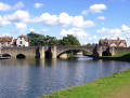
Mainly through riverside meadows and wetlands, this walk passes over the confluence of the River Thames and the River Tame and alongside the distinctive twin chalk hills of Wittenham Clumps to "the quaintest, most old-fashioned inn on the Thames" and past the attractive market town of Abingdon.
For more walks, use our search engine .
The GPS track and description are the property of this route's author. Please do not copy them without permission.

