


5th Oct - Day 31 - Clitheroe To Newton-in-Bowland
Details
Creation:
Last update:
–
–
-
 Activity: Walking
 -
 Distance: 9.01 mi
 -
 Average duration: 5h 05
 -
 Difficulty: Not specified
 -
-
 Back to start: No
 -
 Ascent: + 1,086 ft
 -
 Descent: - 912 ft
 -
-
 Highest point: 1,220 ft
 -
 Lowest point: 184 ft
-
 Country:
United Kingdom
Country:
United Kingdom
-
 City:
Clitheroe
City:
Clitheroe -
 Start: N 53.874148° / W 2.390383°
 -
 End: N 53.948869° / W 2.464692°
 -


 Hour-by-hour weather


Waypoints
- S : mi 0 - alt. 302 ft - Start on Church Brow
- 1 : mi 0.02 - alt. 299 ft - Turn sharp left onto Church Street
- 2 : mi 0.1 - alt. 266 ft - Turn slight right onto Waddington Road, B6478
- 3 : mi 0.21 - alt. 253 ft - Turn right onto Waddington Road, B6478
- 4 : mi 0.68 - alt. 194 ft - Turn right
- 5 : mi 0.75 - alt. 203 ft - Keep right
- 6 : mi 0.76 - alt. 213 ft - Turn right
- 7 : mi 0.76 - alt. 217 ft - Turn left
- 8 : mi 0.96 - alt. 230 ft - Keep right
- 9 : mi 0.98 - alt. 233 ft - Keep left
- 10 : mi 1.1 - alt. 194 ft - Turn left
- 11 : mi 1.75 - alt. 200 ft - Turn sharp left onto West Bradford Road
- 12 : mi 1.8 - alt. 194 ft - Turn slight right
- 13 : mi 2.19 - alt. 233 ft - Turn left onto Waddington Road
- 14 : mi 2.34 - alt. 276 ft - Turn right
- 15 : mi 2.46 - alt. 305 ft - Turn sharp right onto Moor Lane
- 16 : mi 2.5 - alt. 322 ft - Turn right
- 17 : mi 3.25 - alt. 495 ft - Turn right
- 18 : mi 3.49 - alt. 505 ft - Turn left onto Bowland Gate Lane
- 19 : mi 3.55 - alt. 518 ft - Turn left onto Bowland Gate Lane
- 20 : mi 3.64 - alt. 564 ft - Keep right
- 21 : mi 3.73 - alt. 591 ft - Keep left
- 22 : mi 4.96 - alt. 1,014 ft - Turn right
- 23 : mi 5.32 - alt. 1,066 ft - Turn sharp left
- 24 : mi 5.52 - alt. 1,161 ft - Turn left
- 25 : mi 5.66 - alt. 1,211 ft - Keep right
- 26 : mi 6.37 - alt. 1,096 ft - Turn right
- 27 : mi 7.91 - alt. 453 ft - Turn left
- 28 : mi 7.97 - alt. 459 ft - Turn right
- 29 : mi 8.06 - alt. 463 ft - Turn right
- 30 : mi 8.3 - alt. 443 ft - Turn slight left
- 31 : mi 8.78 - alt. 420 ft - Turn right onto Hallgate Hill, B6478
- 32 : mi 8.93 - alt. 463 ft - Keep left
- E : mi 9.01 - alt. 486 ft
Other walks in the area
Clitheroe River Ribble Circular
 Visorando Member
 8.29 mi
+253 ft
-253 ft
4h 00
8.29 mi
+253 ft
-253 ft
4h 00
 Easy
Departure from Clitheroe (Lancashire)
Easy
Departure from Clitheroe (Lancashire)
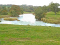
A circular walk starting from Edisford Bridge travelling along the South side of the River Ribble before crossing the river at Gindleton to follow the North side of the river back to start.
Countryside around charming Waddington
1.96 mi
+157 ft
-157 ft
1h 00
Easy
Departure from Waddington (Lancashire)
A short, hillside walk featuring some wonderful panoramas of Pendle, beautiful scenery and lively animals, then replenish your palate at The Lower Buck with some amazing food and drink.
Amble a quiet riverside and peaceful villages around West Bradford
4.03 mi
+75 ft
-75 ft
1h 55
Easy
Departure from West Bradford (Lancashire)
Amble along the well-trodden banks of the Ribble admiring this remarkably quiet section of a hidden industrial quarry.
Uphill and down Dale around Lancashire's prettiest village
4.35 mi
+443 ft
-446 ft
2h 25
 Moderate
Departure from Waddington (Lancashire)
Moderate
Departure from Waddington (Lancashire)
A pleasant afternoon ramble through the pastures above Waddington and up onto the fell for breath-taking views over the Ribble Valley before returning via pretty wooded ghylls for a pint at a bustling pub at the heart of the village.
Panoramic views of Pendle from the Calf's Head, Worston
2.65 mi
+174 ft
-174 ft
1h 20
Easy
Departure from Worston (Lancashire)
Explore the scenic foothills of the splendid Pendle Hill and enjoy panoramic views across the magnificent Ribble Valley, before returning to the cosy Calf’s Head, in the beautiful village of Worston, for a tasty meal.
Ribble Valley riverside path from The Aspinall Arms, Clitheroe
2.63 mi
+49 ft
-49 ft
1h 15
Moderate
Departure from Little Mitton (Lancashire)
A circular pub walk from the Aspinall Arms taking in glorious riverside paths, grazing pastures, ancient lanes and wild moorland of Ribble Valley, with excellent views throughout.
Downham via Worston
 5.89 mi
+407 ft
-384 ft
3h 05
Moderate
Departure from Downham (Lancashire)
5.89 mi
+407 ft
-384 ft
3h 05
Moderate
Departure from Downham (Lancashire)
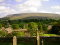
The walk starts from Information Barn Downham and follows the anticlockwise circular route via Worsaw Hill, Worston and Little Mearley Hall.
Pendle Hill from Downham (short version)
 6.37 mi
+1,542 ft
-1,519 ft
4h 15
Moderate
Departure from Downham (Lancashire)
6.37 mi
+1,542 ft
-1,519 ft
4h 15
Moderate
Departure from Downham (Lancashire)
This Lancashire walk starts from the pretty village of Downham and provides a relatively easy ascent of Pendle Hill. In good weather the views are extensive over the Ribble Valley to the Yorkshire Dales and the Southern Lake District, across Burnley to the Southern Pennines and across Clitheroe to the Trough of Bowland. The route is fairly easy to follow although do be careful during the descent as paths shown on maps are not very accurate.
For more walks, use our search engine .
The GPS track and description are the property of this route's author. Please do not copy them without permission.

