


Blackcraig Hill, Glenafton
For more info visit https://gillianswalks.com/2016/11/06/blackcraig-hill/
Details
Creation:
Last update:
-
 Activity: Walking
 -
 Distance: 2.70 mi
 -
 Average duration: 2h 30
 -
 Difficulty: Moderate
 -
-
 Back to start: No
 -
 Ascent: + 1,437 ft
 -
 Descent: - 13 ft
 -
-
 Highest point: 2,283 ft
 -
 Lowest point: 846 ft
-
 Country:
United Kingdom
Country:
United Kingdom
-
 City:
East Ayrshire
City:
East Ayrshire -
 Start: N 55.347047° / W 4.159935°
 -
 End: N 55.333605° / W 4.133792°
 -


 Hour-by-hour weather


Waypoints
- S : mi 0 - alt. 860 ft
- 1 : mi 0.22 - alt. 906 ft - Kissing gate on right
- 2 : mi 1.66 - alt. 1,831 ft - Turn right to follow fence line uphill
- 3 : mi 2.41 - alt. 2,211 ft - Come away from fence - veer right towards cairn
- 4 : mi 2.53 - alt. 2,254 ft - Cairn
- 5 : mi 2.59 - alt. 2,267 ft - Stile
- E : mi 2.7 - alt. 2,283 ft - Trig pillar - Blackcraig Hill summit
Other walks in the area
Blackcraig from Afton Dam
 Association / Club / Walk leader6.13 mi
+1,460 ft
-1,490 ft
4h 05
Association / Club / Walk leader6.13 mi
+1,460 ft
-1,490 ft
4h 05
 Easy
Departure from East Ayrshire
Easy
Departure from East Ayrshire
This walks brings you to Blackcraig summit past Blackcraig Farm.
Afton Dam Circular
 Tourism professional
 4.65 mi
+486 ft
-489 ft
2h 35
Easy
Departure from East Ayrshire
4.65 mi
+486 ft
-489 ft
2h 35
Easy
Departure from East Ayrshire
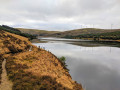
This walk takes you around the perimeter of Glenafton Reservoir just outside New Cumnock. On a still day the water creates stunning reflections of the surrounding hills and forests so remember to take your camera!
Windy Standard from Afton Dam
8.33 mi
+1,299 ft
-1,280 ft
5h 00
Easy
Departure from East Ayrshire
This walk brings you up Windy Standard from Afton Dam. Enjoy views of Afton Reservoir and wind turbines.
Afton Water and Glenafton from Danny's Brig
 Visorando Member2.25 mi
+66 ft
-52 ft
1h 05
Moderate
Departure from East Ayrshire
Visorando Member2.25 mi
+66 ft
-52 ft
1h 05
Moderate
Departure from East Ayrshire
A short walk down to the River Afton, upstream along a path for a mile and then back along a minor road to the parking spot.
Coran of Portmark & Black Craig from Drumjohn, Loch Doon
8.05 mi
+1,693 ft
-1,713 ft
5h 10
Moderate
Departure from Dumfries and Galloway
This circular walk will bring you to visit Minehead. Then, go up to reach Coran of Portmark offering amazing views over Loch Doon Below on a clear day and come back via Black Craig.
Cairnsmore of Carsphairn Loop
7.30 mi
+1,985 ft
-1,985 ft
5h 05
Moderate
Departure from Dumfries and Galloway
A walk among the mountains. Climb and descend the peaks of the Cairnsmore of Carsphairn mountain range.
For more walks, use our search engine .
The GPS track and description are the property of this route's author. Please do not copy them without permission.

