


3rd June 2023
Details
Creation:
Last update:
–
–
-
 Activity: Walking
 -
 Distance: 5.70 mi
 -
 Average duration: 3h 25
 -
 Difficulty: Not specified
 -
-
 Back to start: Yes
 -
 Ascent: + 951 ft
 -
 Descent: - 974 ft
 -
-
 Highest point: 436 ft
 -
 Lowest point: 26 ft
-
 Country:
United Kingdom
Country:
United Kingdom
-
 City:
Poundstock
City:
Poundstock -
 Start/End: N 50.773023° / W 4.562087°
 -


 Hour-by-hour weather


Waypoints
- S/E : mi 0 - alt. 299 ft
- 1 : mi 2.4 - alt. 289 ft - Turn left
- 2 : mi 2.8 - alt. 141 ft - Keep right
- 3 : mi 2.93 - alt. 135 ft - Turn right
- 4 : mi 2.96 - alt. 167 ft - Turn slight left
- 5 : mi 3.35 - alt. 433 ft - Turn left
- 6 : mi 3.73 - alt. 381 ft - Keep left
- 7 : mi 4.84 - alt. 259 ft - Turn slight left
- 8 : mi 5.3 - alt. 203 ft - Turn sharp right
- 9 : mi 5.55 - alt. 266 ft - Keep right
- 10 : mi 5.69 - alt. 299 ft - Turn sharp left
- S/E : mi 5.7 - alt. 302 ft
Other walks in the area
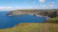
Cambeak and East Wood from Crackington Haven
 Visorando Member
 4.32 mi
+732 ft
-722 ft
2h 35
4.32 mi
+732 ft
-722 ft
2h 35
 Easy
Easy
 Departure from St Gennys (Cornwall)
This circular walk explores the coast next to Cambeak and Tremoutha Haven by the South West Coast path from Crackington Haven to The Strangles. Then you will use peaceful paths inland along a stream in East Wood.
Bude Circular along the canal
5.90 mi
+358 ft
-341 ft
3h 00
 Average
Departure from Bude–Stratton (Cornwall)
Average
Departure from Bude–Stratton (Cornwall)
Well waymarked route along the Bude canal, then across fields to the coastal path.There is an alternative to the very coastal path, which runs alongside further from the edge; it is possible to switch between the paths as you go along.
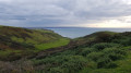
Stowe Cliffs and Coombe Valley from Duckpool
 3.60 mi
+417 ft
-394 ft
2h 00
Easy
Departure from Morwenstow (Cornwall)
3.60 mi
+417 ft
-394 ft
2h 00
Easy
Departure from Morwenstow (Cornwall)
This circular walk with ascents and descents From Duckpool Bay uses the South West Coast path along Warren Gutter and Stowe Cliffs. Then, you will discover peaceful woods and Coombe Valley inland.
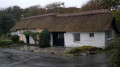
Stowe Barton and Stibb Wood
 3.00 mi
+410 ft
-436 ft
1h 45
Easy
Departure from Kilkhampton (Cornwall)
3.00 mi
+410 ft
-436 ft
1h 45
Easy
Departure from Kilkhampton (Cornwall)
This short walk with ascents and descents explores Stowe Woods and Stibb Woods. You can visit Stowe Barton Farmhouse and Coombe village on your way.
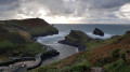
Boscatle Harbour, Penally point and Pentargon Cliff from Boscatle
 4.24 mi
+614 ft
-584 ft
2h 30
Average
Departure from Forrabury and Minster (Cornwall)
4.24 mi
+614 ft
-584 ft
2h 30
Average
Departure from Forrabury and Minster (Cornwall)
This circular walk mostly using the South West Coast path explores Forrabury Stitches, Willapark and Penally Point which overlooks Boscastle Harbour. Then you will walk Pentargon Cliff and will take a panoramic path going back to Boscastle.
Upper Tamar Lake
 3.20 mi
+30 ft
-30 ft
1h 30
Easy
Departure from Kilkhampton (Cornwall)
3.20 mi
+30 ft
-30 ft
1h 30
Easy
Departure from Kilkhampton (Cornwall)
This is an easy family walk around Upper Tamar Lake. On your way, you can even use bird-watching facilities!
Crosstown, Morwenstow Church, and Hawker's Hut
 1.90 mi
+295 ft
-295 ft
1h 10
Easy
Departure from Morwenstow (Cornwall)
1.90 mi
+295 ft
-295 ft
1h 10
Easy
Departure from Morwenstow (Cornwall)
This relatively short route offers some fascinating finds, starting at a 13th-century pub, passing St John's Holy Well, one of the many in Cornwall. Then, through the churchyard, to see the vicarage, with its unusual chimneys, the ship's figurehead, used as a tombstone, and then onto Hawker's Hut, built by an eccentric clergyman, where he spent many hours writing poetry, etc.
For more walks, use our search engine .
The GPS track and description are the property of this route's author. Please do not copy them without permission.

