


River Ayr Way (Failford to Catrine)
For more info visit https://gillianswalks.com/2016/04/13/failford-to-catrine/
Details
Creation:
Last update:
-
 Activity: Walking
-
 Distance: 6.02 mi
-
 Average duration: 3h 05
-
 Difficulty: Easy
-
-
 Back to start: No
-
 Ascent: + 318 ft
-
 Descent: - 200 ft
-
-
 Highest point: 361 ft
-
 Lowest point: 184 ft
-
 Country:
United Kingdom
-
 City:
South Ayrshire
-
 Start: N 55.504794° / W 4.440463°
-
 End: N 55.504421° / W 4.331255°
-


 Hour-by-hour weather


Waypoints
- S : mi 0 - alt. 184 ft
- E : mi 6.02 - alt. 312 ft
Other walks in the area
Peden's Cove, Failford
 Tourism professional
 1.93 mi
+187 ft
-161 ft
1h 05
Easy
Departure from South Ayrshire
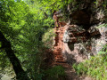
Peden’s Cove is hidden inside Ayr Gorge Woodland, a Scottish Wildlife Trust reserve. This beautiful and ancient woodland is formed around an incredible red sandstone canyon, which gives the water of the River Ayr a vibrant red appearance when the sun shines directly onto it! Peden’s Cove, a set of steps carved into the red sandstone cliffs, is reached a mile along the footpath.
Ayr Gorge Woodlands Reserve, Failford
 3.55 mi
+302 ft
-312 ft
1h 55
 Moderate
Departure from South Ayrshire
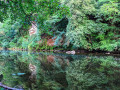
Ayr Gorge Woodlands reserve is the ‘jewel in the crown’ of the Scottish Wildlife Trust Ayrshire. Follow the path of the River Ayr as it flows through a deep red sandstone gorge. This circular / figure-of-eight route takes you around most of the main trails, giving you the opportunity to explore this beautiful ancient woodland including the popular viewpoint at Peden's Cove.
Ballochmyle Viaduct from Catrine
 3.45 mi
+98 ft
-108 ft
1h 40
Easy
Departure from East Ayrshire
Starting in Catrine, follow the course of the River Ayr through woodland to the impressive Ballochmyle Viaduct. It is the highest masonry railway viaduct in Britain and even featured in a scene in the movie Mission: Impossible!
Catrine to Sorn Loop
 4.71 mi
+325 ft
-322 ft
2h 25
Easy
Departure from East Ayrshire
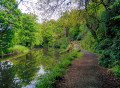
Follow the River Ayr along a pleasant woodland trail to Sorn, passing through Catrine Voes Local Nature Reserve and alongside the historic Catrine Weir. On reaching Sorn, cross the humpbacked ‘Auld Brig’ before passing through part of the village and into the “Spooky Woods”. The return route to Catrine is via Chapel Brae, a pleasant single track road which passes Catrine War Memorial.
Coodham Estate from Kilmarnock
 6.34 mi
+305 ft
-299 ft
3h 10
Easy
Departure from East Ayrshire
This route first crosses Caprington Golf Course and then makes use of paved roads and paths to reach the 95 acre Coodham Estate just outside Symington. Take time to explore the Estate’s many interesting features and paths including the lake, mansion, shrine and graveyard, before starting the walk back to Kilmarnock via the high road past Stafflar Farm.
Caprington Castle via Earlston, Kilmarnock
 3.67 mi
+56 ft
-56 ft
1h 45
Easy
Departure from East Ayrshire
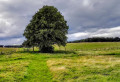
This is a really pleasant walk on the outskirts of Kilmarnock. After crossing Caprington Golf Course past the historical ruin of Blacksyke Tower you will follow a former railway track bed across a field to reach the small hamlet of Earlston. The next stop is Caprington Castle and surrounding woodlands finishing with a wander through the residential part of Caprington.
Kilmarnock to Gatehead Circular
 5.30 mi
+115 ft
-115 ft
2h 30
Easy
Departure from East Ayrshire
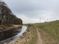
A peaceful walk following the River Irvine between Kilmarnock and Gatehead, returning via the beautiful Caprington Woods and castle.
Prestwick to Troon Sea & Golf Route
 8.02 mi
+30 ft
-26 ft
3h 45
Easy
Departure from South Ayrshire
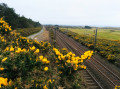
This route follows the Ayrshire Coastal Path between Prestwick and Troon, running alongside both Prestwick and Royal Troon Golf courses. The return leg forms a semi-loop by joining the NCN7 cycle track and then the Smuggler’s Trail across Royal Troon Golf Course. Enjoy the stunning views out across the Firth of Clyde!
For more walks, use our search engine .
The GPS track and description are the property of this route's author. Please do not copy them without permission.

