


visorando2017marco

 Visorando Member
- Location: Anglure-sous-Dun (71170)
- Gender: man
Sign up:
Published route(s)
 The foothills of Dunet from Anglure-sous-Dun via Les Forestiers

 5.27 mi
 +1,070 ft
 -1,056 ft
 3h 20
3h 20
 Moderate
 Departure from Anglure-sous-Dun (Saône-et-Loire)
The valleys and foothills south of Montagne de Dunet (736m) and Dun (709m) through the bocage and forests.
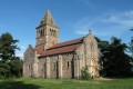
The Montagne de Dun
 6.78 mi
+1,339 ft
-1,332 ft
4h 15
Moderate
Departure from Mussy-sous-Dun (Saône-et-Loire)
6.78 mi
+1,339 ft
-1,332 ft
4h 15
Moderate
Departure from Mussy-sous-Dun (Saône-et-Loire)
A walk through a key site in the history of southern Brionnais, with varied panoramic views towards the Morvan to the north, the Monts de la Madeleine to the west, and the entire Beaujolais Massif to the south.
.
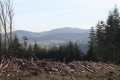
The ridges of Montagne de Saint-Cyr
 6.03 mi
+1,033 ft
-1,004 ft
3h 40
Moderate
Departure from Matour (Saône-et-Loire)
6.03 mi
+1,033 ft
-1,004 ft
3h 40
Moderate
Departure from Matour (Saône-et-Loire)
Large circular figure-of-eight on Mont Saint-Cyr (771m) located near Montmelard, Aigueperse and Matour
starting from En Crozan (769m).
Discover beautiful panoramic views of the Morvan, Mont Blanc, Mont Saint-Rigaud and Puy de Dôme. Wander through meadows, Douglas firs, holly, beech and oak trees.