


Thom

 Visorando Member
- Gender: man
Sign up:
Published route(s)
 Pic de la Soucarrane
 9.71 mi
 +4,183 ft
 -4,183 ft
 8h 05
8h 05
 Difficult
 Departure from Auzat (Ariège)
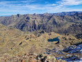
A day-long hike taking you to an altitude of almost 3,000 metres and offering splendid views of the French and Spanish Pyrenees.
The hike starts in the valley at 1,926 m and gradually climbs to the peak at 2,902 m.
Plan to spend the day with a picnic on the banks of the Soucarrane lake, which is very pleasant in good weather.
Please note that some sections along the ridges are not recommended for people who are prone to vertigo.