


randolesarcs83

 Visorando Member
Sign up:
Published route(s)
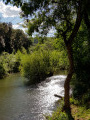
 Les Arcs-sur-Argens - L'Apié de Raybaud
 2.15 mi
 +335 ft
 -338 ft
 1h 15
1h 15
 Easy
Easy
 Departure from Les Arcs (Var)
A family hike that allows you to discover the banks of the Aille and Argens rivers and explore the flora of the communal forest of Les Arcs-sur-Argens
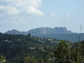
Cabredor circuit
 5.00 mi
+531 ft
-548 ft
2h 45
Easy
Departure from Les Arcs (Var)
5.00 mi
+531 ft
-548 ft
2h 45
Easy
Departure from Les Arcs (Var)
This circular is ideal for a lovely family outing. Its largely shaded route offers beautiful views of the Argens, the Barres de Pouaré and the Rocher de Roquebrune.
This circuit also offers the opportunity to climb to the summit of Cabredor and cross the oppidum that occupies it.