


ptpaz73

 Visorando Member
Sign up:
Published route(s)
 Belle Étoile circular, return via Chalet Périllet
 4.07 mi
 +2,484 ft
 -2,484 ft
 4h 00
4h 00
 Moderate
 Departure from Mercury (Savoie)
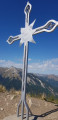
From the summit of Belle Étoile, you will be treated to breathtaking views. Following a path that runs almost entirely through the woods, you will reach the Croix de Périllet and then, after a steep section, the Croix du Sommet de Belle Étoile. On one side, you will overlook Mercury and the Olympic city of Albertville (1992 Winter Olympics) and on the other, the Tamié valley and its Cistercian-Trappist monastery. In the distance, you can see Lake Annecy, Mont Blanc and Mont Granier.
Short tour around Lake Roselend
 9.89 mi
+1,657 ft
-1,667 ft
6h 00
Moderate
Departure from Beaufort (Savoie) (Savoie)
9.89 mi
+1,657 ft
-1,667 ft
6h 00
Moderate
Departure from Beaufort (Savoie) (Savoie)
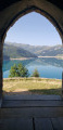
You've seen some of it on foot, by bike, motorbike or car. If you're a keen walker, here's your chance to discover Lake Roselend, its dam and the alpine chalets that line its shores from different angles on an easy walk along a route that follows the lake's banks, with an elevation gain of around 400 metres. You will cross numerous streams via wooden footbridges before finally crossing the dam.