


Pierrot07

 Visorando Member
- Location: Saint-Remèze (07700)
Sign up:
Published route(s)
 Dent de Rez via Baravon
 7.07 mi
 +1,339 ft
 -1,312 ft
 4h 25
4h 25
 Moderate
 Departure from Gras (Ardèche)
This path, much less travelled than the classic route, allows you to bypass the massif to the north with magnificent views of the Ardèche mountains and the immense wild forest, which is aptly named because it is very, very wild...
It is also the most accessible route for vehicles to reach the summit, but it is of course prohibited to vehicles and reserved for site management personnel; barriers prevent vehicles from crossing.
Dent de Rez via the Col d'Eyrole
 4.24 mi
+1,027 ft
-1,027 ft
2h 50
Moderate
Departure from Gras (Ardèche)
4.24 mi
+1,027 ft
-1,027 ft
2h 50
Moderate
Departure from Gras (Ardèche)
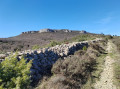
Ascent to the highest peak of the Plateau des Gras, which, in good weather, offers a magnificent 360-degree panorama of the Upper Ardèche, the Cévennes, the Vercors and Provence. A hike with no major difficulties, though take particular care at the summit due to the presence of cliffs, which are not very high but dangerous nonetheless.
Be sure to follow the route in the direction indicated to enjoy the ‘wow’ factor when you reach the summit.