


Orace

 Visorando Member
Sign up:
Published route(s)
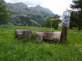
 The Croix de L'Alpe from La Rente
 7.39 mi
 +3,061 ft
 -3,048 ft
 6h 05
6h 05
 Difficult
 Departure from Enchastrayes (Alpes-de-Haute-Provence)
A round trip to this promontory offers a unique view of the entire Ubaye Valley, from the bell tower of Méolans-Revel to the Pas de la Reyssole.
Please note: at (5), the markings become difficult to read and the passage itself is technical.
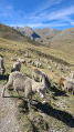
Lac de Terres Plaines from the Col de Restefond road
 6.65 mi
+1,634 ft
-1,634 ft
4h 30
6.65 mi
+1,634 ft
-1,634 ft
4h 30
 Moderate
Departure from Jausiers (Alpes-de-Haute-Provence)
Moderate
Departure from Jausiers (Alpes-de-Haute-Provence)
A round trip to this high-altitude lake located in a cirque at the foot of the Chevalier (2,886 m). The trail overlooks the Terres Plaines valley and its endless shades of green.
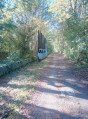
Route from Les Molières to Pecqueuse
 6.66 mi
+79 ft
-79 ft
3h 10
Moderate
Departure from Les Molières (Essonne)
6.66 mi
+79 ft
-79 ft
3h 10
Moderate
Departure from Les Molières (Essonne)
This rural route will take you to Pecqueuse, where you can admire the town of Limours from the viaduct overlooking it. You will also discover the old aerotrain line, now converted into a greenway discreetly hidden under the canopy.