


mszabo

 Visorando Member
Sign up:
Published route(s)
 La Tour des Bois, starting from La Tour-de-Sçay
 5.41 mi
 +922 ft
 -896 ft
 3h 20
3h 20
 Moderate
 Departure from La Tour-de-Sçay (Doubs)
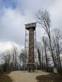
Climb the 146 steps of the Tour des Bois to discover a 360° panorama from a height of 26 metres.
A third of the route is through woodland and the rest follows a track through the wind farm, one of the largest in France, which is shared between Rougemont, La Tour-de-Scay and Autechaux, in the Central Doubs. On clear days, you can see 36 of the farm’s 43 wind turbines from the top of the tower.
 Easy
Easy