


mat.i.eu

 Visorando Member
Sign up:
Published route(s)
 Pic d'Anie from Pierre Saint-Martin and via the Col du Pescamou
 8.39 mi
 +3,337 ft
 -3,314 ft
 6h 45
6h 45
 Difficult
 Departure from Arette (Pyrénées-Atlantiques)
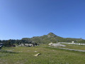
From La Pierre Saint-Martin, you can see the Pic d'Anie in the distance.You start at the foot of the slopes with your destination in sight, and it takes about 3½ hours to reach the summit. In summer, you won't be alone on this route.
A circular walk in Pagoeta Natural Park
 2.36 mi
+446 ft
-446 ft
1h 30
2.36 mi
+446 ft
-446 ft
1h 30
 Easy
Departure from Aia (Gipuzkoa)
Easy
Departure from Aia (Gipuzkoa)
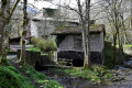
A short family walk, just as lovely in spring, summer and autumn. You’ll pass through a botanical garden, walk alongside a small river and emerge at the Forge d’Agorregi. Dating back to 1754, it’s still in working order and a delight to behold.
The Aphatarena footbridges
 2.15 mi
+285 ft
-282 ft
1h 15
Easy
Departure from Orègue (Pyrénées-Atlantiques)
2.15 mi
+285 ft
-282 ft
1h 15
Easy
Departure from Orègue (Pyrénées-Atlantiques)
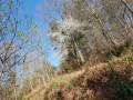
A short discovery route in the Bois de Mixe designed for children. A pleasant 3.5 km route, featuring rope bridges and giant’s steps (square stone blocks), which winds its way along the river. Simply follow the signs explaining life in the forest. An easy walk for the whole family, suitable for children aged
4 years old.