


MAROTZKI

 Visorando Member
Sign up:
Published route(s)
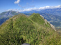
 Mont Vorassay via the Bionnassay glacier and the Col de Tricot
 6.37 mi
 +3,248 ft
 -3,225 ft
 5h 45
5h 45
 Difficult
 Departure from Saint-Gervais-les-Bains (Haute-Savoie)
This route does not present any particular difficulties, except for a significant elevation gain (over 1,100 metres), which classifies it as difficult.
It reaches the summit of Mont Vorassay after the Col de Tricot and passes close to the Bionnassay glacier. There are magnificent views of the refuge and the Aiguille du Goûter as well as the Aiguille de Bionnassay. The descent is very pleasant and passes through a beautiful forest.
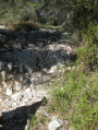
Fort de la Croix Faron starting from Toulon
 3.62 mi
+1,427 ft
-1,427 ft
2h 55
3.62 mi
+1,427 ft
-1,427 ft
2h 55
 Moderate
Departure from Toulon (Var)
Moderate
Departure from Toulon (Var)
Route on the rocky slopes of Mont Faron, starting between Toulon and La Valette-du-Var, practically in the town centre.
The appeal of this hike is its slightly challenging and wild nature in the immediate vicinity of Toulon.