


manwe14

 Visorando Member
Sign up:
Published route(s)
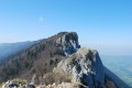
 The Dent du Chat and the Roc de Cornillon
 4.25 mi
 +2,720 ft
 -2,703 ft
 4h 20
4h 20
 Difficult
 Departure from La Chapelle-du-Mont-du-Chat (Savoie)
This is a lovely half-day hike with beautiful views of Lac Du Bourget, Aix-Les-Bains and the Chambérien basin, the Belledonne massif and Mont Blanc on one side, and the Savoyard foothills (Yenne, Belley, Grand Colombier) on the other.
Please note: Those who are afraid of heights may be affected by some technical sections equipped with cables or ladders.
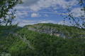
Notre-Dame de la Montagne and the Chevru Cross on the heights of Yenne.
 4.30 mi
+909 ft
-909 ft
2h 45
4.30 mi
+909 ft
-909 ft
2h 45
 Easy
Departure from Yenne (Savoie)
Easy
Departure from Yenne (Savoie)
A hike in partial shade and partial sun on the heights of Yenne, offering beautiful panoramic views of Mont du Chat and the Rhône plain. Beautiful views of the Gorges de la Balme, the Château de Pierre Châtel and Fort les Bancs.
Lac de la Croix and Lac du Sambuis via the Col du Sambuis
 5.78 mi
+2,438 ft
-2,434 ft
4h 45
5.78 mi
+2,438 ft
-2,434 ft
4h 45
 Moderate
Departure from Saint-Colomban-des-Villards (Savoie)
Moderate
Departure from Saint-Colomban-des-Villards (Savoie)
A lovely day's hike with breathtaking views of the Aiguilles de l'Argentière, offering plenty of refreshment thanks to a myriad of lakes and, in the background, the Aiguilles d'Arves and La Meije.