


laurentchuillet

 Visorando Member
Sign up:
Published route(s)
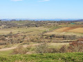
 From Foissac to Vernet-le-Bas
 4.67 mi
 +564 ft
 -564 ft
 2h 40
2h 40
 Moderate
 Departure from Foissac (Aveyron)
A very scenic route that follows an old path once used by locals to link Foissac to Vernet-le-Bas. This walk alternates between sections through woodland and open areas offering lovely views of the valley.
A route with a bit of an elevation gain but not very difficult on foot. It can also be done by mountain bike.
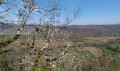
From Camp de la Borie to Mas de Renayac
 4.88 mi
+240 ft
-240 ft
2h 25
4.88 mi
+240 ft
-240 ft
2h 25
 Easy
Departure from Foissac (Aveyron)
Easy
Departure from Foissac (Aveyron)
An easy family walk on the Causse plateau between Foissac and the cliffs of the Lot Valley. At the recently restored Mas de Renayac, you’ll enjoy a beautiful view of the Lot Valley, with Larroque-Toirac Castle opposite.
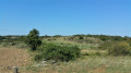
Larroque-Toirac and Pech de Bourrou viewpoint
 3.78 mi
+738 ft
-715 ft
2h 25
Easy
Departure from Larroque-Toirac (Lot)
3.78 mi
+738 ft
-715 ft
2h 25
Easy
Departure from Larroque-Toirac (Lot)
A lovely walk in the hills above Larroque-Toirac, offering a different perspective on the Lot valley. Viewpoints on the cliff edge overlooking the Lot valley and a walk on the limestone plateau. A short hike through woodland and open spaces. Suitable footwear is recommended.