


LATAPIEJp

 Visorando Member
 Premium user
 - Gender: man
Sign up:
Published route(s)
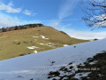
 Summit of Oudérou from Binos
 6.25 mi
 +2,858 ft
 -2,854 ft
 5h 20
5h 20
 Moderate
 Departure from Binos (Haute-Garonne)
A very pretty early winter circuit to be done on foot or snowshoes depending on the snow conditions. Its good south-eastern exposure allows you to walk in the sun, which is appreciated in cold weather.
A very picturesque hike through the village, beautiful beech forests and the sumptuous panorama from the summit.
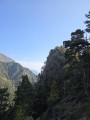
The Baricave Tower, Rioumajou Valley
 4.36 mi
+1,788 ft
-1,791 ft
3h 35
Moderate
Departure from Saint-Lary-Soulan (Hautes-Pyrénées)
4.36 mi
+1,788 ft
-1,791 ft
3h 35
Moderate
Departure from Saint-Lary-Soulan (Hautes-Pyrénées)
A pretty mid-mountain circular, straddling two valleys, Baricave and Rioumajou, which allows those who wish to do a little climbing to reach the summit, but without obligation.
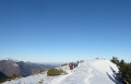
Pic de Montaut from Nistos Cap Nestès
 6.20 mi
+2,277 ft
-2,257 ft
4h 50
Moderate
Departure from Sarrancolin (Hautes-Pyrénées)
6.20 mi
+2,277 ft
-2,257 ft
4h 50
Moderate
Departure from Sarrancolin (Hautes-Pyrénées)
A beautiful ridge hike offering superb views of the Aure Valley, to be done on foot or with snowshoes.
No fewer than four peaks along the route, a real rollercoaster ride in the Pyrenees.