


Guibace-Évasion

 Visorando Member
 Premium user
 - Location: Mondragon (84430)
- Gender: man
- Website: https://www.instagram.com/guibace_evasion
Sign up:
Published route(s)
 Mont Pelat and Lac d'Allos
 8.76 mi
 +3,179 ft
 -3,202 ft
 6h 50
6h 50
 Difficult
 Departure from Allos (Alpes-de-Haute-Provence)
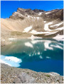
It is renowned as the easiest 3,000-metre peak in the Southern Alps. To the north, it overlooks the glacial site of Lac d'Allos, the largest high-altitude lake in Europe at 2,227 metres: Mont Pelat, in the Mercantour National Park, is the highest point in the Haut Verdon.
 Moderate