


estelle71

 Visorando Member
 Premium user
 Sign up:
Published route(s)
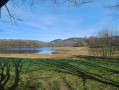
 Valleys and forests of the Ambazac mountains from Jonas Pond.
 8.60 mi
 +1,129 ft
 -1,145 ft
 4h 55
4h 55
 Moderate
 Departure from Ambazac (Haute-Vienne)
Circular route with varied scenery, often through woodland, partly along the Monks’ Trail. Magnificent in the autumn colours of the LimousinNote from the moderator: the route was amended on 11 May 2023 due to issues with private land; instead of heading to point 4 across the fields after going round the pond, the route now passes through Bourdaleine.
Short Chamois Trail at Septmontcel
3.50 mi
+1,286 ft
-1,319 ft
2h 45
Moderate
Departure from Septmoncel (Jura)
A very steep section of the Sentier des Chamois trail offers views of the rugged terrain of the Flumen Gorges and the Gendarme's Hat, as well as a cool break at the waterfall. You will need good walking shoes as the slopes are steep.