


- Emilie -

 Visorando Member
- Gender: woman
Sign up:
Published route(s)
 Lac de Roy and Pointe du Haut Fleury
 5.09 mi
 +1,237 ft
 -1,227 ft
 3h 25
3h 25
 Moderate
 Departure from Taninges (Haute-Savoie)
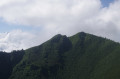
The wide path that leads to this unexpected lake is very pleasant and easy to walk on.
You will quickly enjoy a wide panorama of Mont Blanc and the surrounding peaks until you reach a small glacial lake up to 10 m deep.
From the lake, I suggest taking the path to Pointe du Haut Fleury. A beautiful view awaits you there, along with two orientation tables.
Pointe de Chalune via Chalet Blanc
 3.99 mi
+1,844 ft
-1,844 ft
3h 25
Moderate
Departure from Mieussy (Haute-Savoie)
3.99 mi
+1,844 ft
-1,844 ft
3h 25
Moderate
Departure from Mieussy (Haute-Savoie)
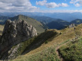
A must-do and very popular hike in the Sommand area. Located at over 2,000 m, the Pointe de Chalune is accessible and does not present any particular difficulty. However, don't underestimate the 578 m climb to reach the summit, a small plateau topped by a cairn, where you can enjoy a 360° panorama.