


Denis_Nozieres

 Visorando Member
- Location: Allègre (43270)
- Gender: man
Sign up:
Published route(s)
 The ridges above Saint-Sauveur-de-Montagut
 12.94 mi
 +2,451 ft
 -2,454 ft
 8h 05
8h 05
 Difficult
 Departure from Saint-Sauveur-de-Montagut (Ardèche)
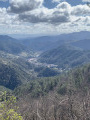
Before reaching the peaks, walk through the terraces, also known as faïsse or chalet, planted with chestnut trees and typical hamlets. The peaks offer an almost 360° view: the Alps, the Vercors and the Mézenc mountain range.
The Pic de Saint-Romain-de-Lerps and Glun from Châteaubourg
9.41 mi
+1,759 ft
-1,759 ft
5h 50
 Moderate
Departure from Châteaubourg (Ardèche)
Moderate
Departure from Châteaubourg (Ardèche)
Pending an alternative, this hike, which passes through private property between (11) and (12), is currently prohibited.
Starting from Châteaubourg, you will cross the appellation vineyards to reach the Pic de Saint-Romain-de-Lerps, where you will have a 360° view of the Monts d'Ardèche and the Rhône Valley, with the Vercors and the Alps in the background. The orientation table will show you all this.