


berna10

 Visorando Member
Sign up:
Published route(s)
 Saint-Ferreol
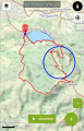
 8.81 mi
 +988 ft
 -997 ft
 4h 55
4h 55
 Moderate
 Departure from Revel (Haute-Garonne)
Section of the "sentier des sommets" trail, cut off from the link with Revel, reducing the total distance to 14 km.
No technical difficulties, with beautiful views of the Lauragais. The route ends with a shaded walk around the lake, where you can swim in season.
Bagatelle Trail
 4.51 mi
+440 ft
-440 ft
2h 25
4.51 mi
+440 ft
-440 ft
2h 25
 Easy
Departure from Parisot (Tarn)
Easy
Departure from Parisot (Tarn)
Hop over hills through woods and vineyards... on the Bagatelle trails.
This route does not pass through private property and access is "public". See link from Monday 16 September 2019 at 10:59 in: Give your opinion or leave a message.
However, "All picking is strictly prohibited under Articles 547... 379 381 of the Penal Code"