


ArouG

 Visorando Member
Sign up:
Published route(s)
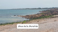
 The Vallée des Moulins, Mondrée beach and the two ports at Fermanville
 7.71 mi
 +358 ft
 -354 ft
 3h 50
3h 50
 Moderate
 Departure from Fermanville (Manche)
Between woods and the seaside, this hike requires waterproof shoes after rain (risk of mud).There is little elevation gain but a variety of terrain: a section of paved road, a coastal path and a sandy section.
Discovering Fermanville: land, sea and Mange-Cailloux
 12.96 mi
+932 ft
-928 ft
6h 45
12.96 mi
+932 ft
-928 ft
6h 45
 Difficult
Departure from Fermanville (Manche)
Difficult
Departure from Fermanville (Manche)
A walk that allows you to discover most of the points of interest around Fermanville. The figure-of-eight route comprises a long circular loop (15.5 km) and a short one (7.5 km).
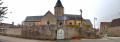
Circular route between Fermanville and Cosqueville
 8.40 mi
+328 ft
-338 ft
4h 10
Moderate
Departure from Fermanville (Manche)
8.40 mi
+328 ft
-338 ft
4h 10
Moderate
Departure from Fermanville (Manche)
Between Fermanville and Cosqueville, this route between coastal and inland landscapes will allow you to discover landscapes and viewpoints that are less frequented than the more famous ones in the Vallée des Moulins or the coastal path between the two ports of Fermanville (Lévy and Pignot).