


ArnaudR31

 Visorando Member
Sign up:
Published route(s)
 Pic de Cabaillère
 7.23 mi
 +2,890 ft
 -2,871 ft
 5h 50
5h 50
 Difficult
 Departure from Ariège
The hike is not particularly difficult, but it is quite steep overall.
Please note: good mountain navigation skills are necessary; using a map or GPS is not a luxury and will help you find your way more easily.
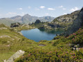
The view from the summit is superb, as is the view along the climb, with views of the beautiful Jasse de Pinet, the Pic du Ruhle and its refuge, the Pic de la Coume d'Enfer, etc.