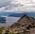
Byre Inn To Loch Drunkie
Technical sheet
Creation:
Last update:
–
–
-
 Activity: Walking
 -
Distance: 7.04 km
-
Average duration: 2h 15
-
Difficulty: Not specified
-
-
Return to departure point: Yes
-
Vertical gain: + 93 m
-
Vertical drop: - 90 m
-
-
Highest point: 159 m
-
Lowest point: 84 m
-
Country: United Kingdom
-
-
District: Stirling
-
Start/End: N 56.22815° / W 4.36886°
Waypoints
- S/E : km 0 - alt. 86 m - Park in the Byre Inn Car Park at Brig o’ Turk.
- 2 : km 0.01 - alt. 86 m - Walk to Brig o’ Michael across the Black Water and then through the farmyard to a gate (normally open). Continue along the farm road turning left after 100 yards. You are now on the “Three Lochs Driveâ€, but there is unlikely to be any traffic at this time of the year and, even if there is, traffic should be travelling at or below the 10mph speed limit!
- 3 : km 3.19 - alt. 132 m - After 2 miles along this road, by the “Fisherman’s Car Parkâ€, turn left onto a track leading down to Loch Drunkie, where a tourist track is followed round the lochside to reach the toilet block set up by the Forestry Commission for a “banana break†(the toilets are, however, closed for the winter).
- 4 : km 5.16 - alt. 110 m - From here, we return along the aforementioned “Three Lochs Driveâ€/NCN7 cycleway for 200 yards where we turn left onto a track that eventually turns into a muddy path, leading eventually back to the “Three Lochs Driveâ€. We then return along our original route to the Byre Inn.
- S/E : km 7.04 - alt. 87 m
Other walks in the area
 Ben A'an, Trossachs

The iconic pointed peak of Ben A’an in the Trossachs is a fantastic wee climb and the views of Loch Katrine and Ben Venue from the top are nothing short of spectacular. With a clear and well-worn footpath all the way to the top, this particular route takes you back down the other side of the hill, through some forest to the banks of Loch Katrine to form a loop.
 Loch Ard Sculpture Trail

Dog friendly circular walk along Loch Ard. This walk follows the sculpture trail waymarked in red.
 The Three Bridges of Callander
Enjoy a moderate stroll through woodland and open fields taking in surrounding peaks and the chance of spotting distinctive wildlife.
 Callander Meadows
This is a very pleasant level riverside route with lots of wildlife and wild flowers by the banks of the River Teith.
 The Glacier Trail
Explore some of this area’s geology on the low-level glacier trail. It starts near the Roman Camp Hotel at the east end of Main Street and follows a short stretch of the River Teith.
For more walks, use our search engine .
The GPS track and description are the property of the author. Do not copy them without permission.


