In the footsteps of Montgrenier Castle to the Pic de Montgailhard

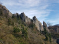
It’s impossible to spend a few days in Montgailhard without climbing the local ‘peak’, the ‘Pain de Sucre’ of Montgailhard (in Occitan) or Montgaillard (in French), also grandly known as the ‘Pic de Montgailhard’ or Costebelle on the land registry.
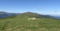
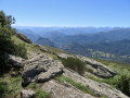
From the summit rock at an altitude of 627 metres, there are beautiful views of the surrounding countryside, set in completely unspoilt natural surroundings.
In the Middle Ages, each hilltop was crowned by a castle or a watchtower.
At the summit of the peak, you can play at being an archaeologist by searching for the remains of a stronghold of the County of Foix, the Château de Montgrenier (built in the 12th century and demolished on the orders of Louis XIII), of which at least one square tower still stood in 1673.
But the circular walk first takes us to ‘Le Château’ in the village centre, then up a small hill known as ‘Le Castel’ (the castle)...
All that’s missing are the men-at-arms to transport us straight into the heart of feudal warfare.

Details

62562969
Creation:
Last update:
Last review:
  • Walking
    Activity: Walking
  • ↔
    Distance: 2.03 mi
  • ◔
    Average duration: 1h 30 
  • ▲
    Difficulty: Easy

  • ⚐
    Back to start: Yes
  • ↗
    Ascent: + 656 ft
  • ↘
    Descent: - 636 ft

  • ▲
    Highest point: 2,005 ft
  • ▼
    Lowest point: 1,427 ft

Photos

Description of the walk

Park in the village square, Place des Écoles, very close to the church and the aptly named Rue du Pic.
The route is not signposted. The route begins in the heart of the village, through the streets. Use the street signs to find your way.

(S/E) Cross the square to reach Rue de la Gaille to the east, where, at number 7, you’ll find a pretty old fortified building, flanked by two square towers with narrow windows (probably former arrow slits), known as ‘Le Château’ (which is not the Château de Montgrenier). One of these towers is particularly elegant, with its machicolated battlements. The building also features a beautiful studded door surmounted by a wrought-iron balcony, a more recent addition.
Take a look at the rear of the building via the start of Chemin de Pédarque.

Continue along Rue de la Gaille towards the north-west. Leave all the perpendicular streets on your left. At the Fork in the road, leave the street on your right and continue to the left, then straight on to No. 14.

(1) Take the small path that starts between nos. 12 and 14. Walk north-east for a few dozen metres until you reach a junction.

(2) Turn left and head for the summit of the rocky outcrop, known as “Le Castel”, at an altitude of 468 m. A cross on the summit faces the village. There is a lovely view over the village streets to the south.
Retrace your steps to the crossroads and turn left onto a shaded path.
Continue roughly eastwards for about 200 m until you reach another junction.

(3) Turn right, still under dense foliage. You’ll reach a tarmac road, the Chemin de Pédarque (which leads to “Le Château” in the village centre at its end).
Walk for about 200 m until you reach the crossroads, the start of the path to the Pic de Montgailhard or Pain de Sucre.

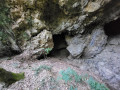
(4) A sign indicates the peak is 1 km away (0h30). The real ascent begins from here. 30 m after the junction, take a detour to the right, climbing steeply to reach a major geological fault hidden in the forest. Above it lies the village’s drinking water reservoir. Retrace your steps and resume the ascent.
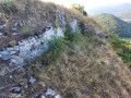
The ascent takes you just over half a lap around the peak, entirely through the forest. The path emerges from the forest onto the southern face shortly before a junction.

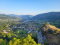
(5) Then turn right onto the serrat (the ridge), staying on the path. Go round the final rock from the right (east) and reach a rock overlooking the peak from its northern face. There is a beautiful view over the valley and as far as Foix and its castle, situated at the confluence of the Arget and Ariège rivers.
Retrace your steps and go round the summit to the right (west). You’ll reach a summit marker and a recently installed orientation board.
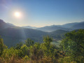
From here, there is a stunning 180° view from east to west. Farthest to the left is Roquefixade Castle, nearly 9 km away, in Tarascon-sur-Ariège, via Montségur.

For the return journey, complete the short circular loop around the summit and head back to the junction.

(5) Continue straight down, heading due south. Almost at the bottom of the hill, the path meets the Chemin de Costebelle, goes round the base of the hill and heads back towards the north-west. The path reaches the village via Rue du Tartie, next to the cemetery. Turn left immediately onto the street. At the end of the street, continue along the very narrow path, which leads out onto Rue de la Roucateille at No. 17.
Turn right and continue to the Place des Écoles (S/E).


Waypoints

  1. S/E : mi 0 - alt. 1,427 ft - Place des Ecoles - Montgailhard (09)
  2. 1 : mi 0.21 - alt. 1,437 ft - 12–14 Rue de la Gaille
  3. 2 : mi 0.26 - alt. 1,470 ft - Croisement du Castel (Calvaire)
  4. 3 : mi 0.51 - alt. 1,453 ft - Crossroads
  5. 4 : mi 0.71 - alt. 1,460 ft - Start of the Pain de Sucre ascent trail
  6. 5 : mi 1.29 - alt. 1,959 ft - Junction towards - Le Pain de Sucre (627m)
  7. S/E : mi 2.03 - alt. 1,427 ft - Place des Ecoles - Montgailhard (09)

Notes

Difficulty
I have rated this walk as ‘Easy’, because although there is a short, challenging climb, the route is straightforward and the elevation gain is very modest.
The IBP Index (an automated system for assessing the difficulty of a route), a partner of the FFRandonnée, is 38 HKG, which corresponds to an ‘Easy’ route for a hiker of average fitness.

Time
I completed this route in 1 hour 30 minutes. This is a rather short time, even allowing for a few photo breaks.
However, you should allow between 2 and 3 hours.

Equipment
Bring basic hiking or running gear.

Drinking water and shelter
There is no free access to drinking water or shelter on the trails, but there are plenty of places to take shelter in the village.

Worth a visit

Reviews and comments

5 / 5
Based on 2 reviews

Reliability of the description
5 / 5
Ease of following the route
5 / 5
Route interest
5 / 5
User 26581514

Overall rating : 5 / 5

Date of your route : Jul 31, 2025
Reliability of the description : ★★★★★ Very good
Ease of following the route : ★★★★★ Very good
Route interest : ★★★★★ Very good
Very busy route : No

We completed the circuit in just over two hours with our two children aged seven and ten.
The climb is tough, I wouldn't say it's easy, but we're novice hikers.
The first part of the descent isn't very safe.
The view is worth it though!

Machine-translated

randonneur 21
randonneur 21

Overall rating : 5 / 5

Date of your route : Jun 05, 2025
Reliability of the description : ★★★★★ Very good
Ease of following the route : ★★★★★ Very good
Route interest : ★★★★★ Very good
Very busy route : Yes

short hike with a low gradient but still a good climb to reach the summit with beautiful views
take care on the first part on the way down

Machine-translated

Other walks in the area

For more walks, use our search engine .

The GPS track and description are the property of this route's author. Please do not copy them without permission.