Saltria

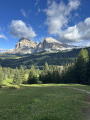
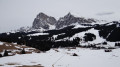
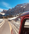
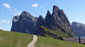
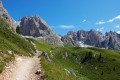
Compatsch is the gateway to the Alpe di Siusi. This mountain pasture, the largest in Europe, offers a breathtaking view of the Dolomites in South Tyrol, Italy. The panorama in the foreground stretches from the Schlern massif, including Punta Santern, to the Langkofel Group, featuring the Langkofel and the Plattkofel. In the distance lie the Sella massif with Piz Boé, and the Geisler massif with Seceda and Saas Rigais. This circular route offers magnificent views of these ‘bellissime montagne delle Dolomiti’.

Details

1874151
Creation:
Last update:
Last review:
  • Walking
    Activity: Walking
  • ↔
    Distance: 6.59 mi
  • ◔
    Average duration: 3h 50 
  • ▲
    Difficulty: Moderate

  • ⚐
    Back to start: Yes
  • ↗
    Ascent: + 938 ft
  • ↘
    Descent: - 938 ft

  • ▲
    Highest point: 6,319 ft
  • ▼
    Lowest point: 5,495 ft

Photos

Description of the walk

To reach Castelrotto: Take the Brenner motorway and exit at Ponte Gardena if approaching from the north, or at Bolzano Nord if approaching from the south.
To get to Compatsch, the start of the hike:

  • by bus from Castelrotto.
  • by bus from Castelrotto to Siusi, then the cable car.

(S/E) Head due east along the Saltria road (traffic-restricted road) until you reach the junction with the access road to the Steger Dellai hotel.

(1) Continue to the right along the path named Paula Hans Steger until you rejoin the Saltria road.

(2) Do not return to the Saltria road; take the path branching off to the right towards the south, heading for the Römeralm chapel. Follow this path, which also ends at the Saltria road.

(3) Reach Saltria via the road, passing the Hotel Saltria.

(4) Walk past the Hotel Brunelle and take the path that climbs northwards. You will come to another junction.

(5) Continue left towards the west, skirting an area on your right called “Biotop Moos Col da Fil”.

(6) You’ll cross a small path coming from the north. Continue left towards the west to reach the Saltria road, clearly visible in the distance, as you approach another area on your left called “Biotop Großes Moos”.

(7) Join the road on the right until you reach the junction with the road to the Steger Hotel.

(1) Head right to return to Compatsch (S/E) via a path running parallel to the outward route.

Waypoints

  1. S/E : mi 0 - alt. 6,043 ft - Compatsch
  2. 1 : mi 0.63 - alt. 6,112 ft - Junction of the Saltria Road and the road to the Steger Hotel
  3. 2 : mi 1.88 - alt. 6,102 ft - Junction of the Paula Hans Steger trail and the Saltria road
  4. 3 : mi 2.74 - alt. 5,571 ft - Saltria Road junction
  5. 4 : mi 3.07 - alt. 5,509 ft - Saltria
  6. 5 : mi 3.91 - alt. 6,060 ft - Path junction
  7. 6 : mi 4.23 - alt. 6,102 ft - Crossroads.
  8. 7 : mi 5.23 - alt. 6,115 ft - Junction with the Saltria road
  9. S/E : mi 6.59 - alt. 6,043 ft - Compatsch

Worth a visit

  • Castelrotto.
  • Schlern Massif.
  • Punta di Santner.
  • Alpe di Siusi.
  • Langkofel Group.
  • Sella Group.
  • Geisler Group.
  • Puez Group.

Reviews and comments

5 / 5
Based on 2 reviews

Reliability of the description
5 / 5
Ease of following the route
5 / 5
Route interest
5 / 5
sixtheye
sixtheye

Overall rating : 5 / 5

Date of your route : Sep 23, 2024
Reliability of the description : ★★★★★ Very good
Ease of following the route : ★★★★★ Very good
Route interest : ★★★★★ Very good
Very busy route : No

A lovely, enjoyable walk through pastures and woodland. Stunning views of the Dolomites.

Machine-translated

Morgane S
Morgane S

Overall rating : 5 / 5

Date of your route : Apr 15, 2024
Reliability of the description : ★★★★★ Very good
Ease of following the route : ★★★★★ Very good
Route interest : ★★★★★ Very good
Very busy route : No

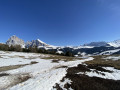
A magnificent walk in the heart of the Dolomites! We did this walk out of season, so we were on our own, with snow still underfoot in a few places (wet shoes by the end, but it was well worth it).
The perfect time of year for this walk. Well worth doing again and again!

Machine-translated

Other walks in the area

For more walks, use our search engine .

The GPS track and description are the property of this route's author. Please do not copy them without permission.