Country:

 City:
City:




Car park available at the bend in the N884, at the junction with Rue d’Herbeumont in Sainte-Cécile and not far from the Priory of Conques. Just under 3 km from the centre of Sainte-Cécile and 1.7 km from the Priory of Conques. Turn onto the dirt track and, 50 m further on, the ‘P’ sign confirms that parking is permitted here.
(S/E) With your back to the N884, take the forest track on the right and go round the red-and-white barrier.
Red Rectangle 8 signpost
Walk for about 900 m, ignoring any side paths, until you reach a junction.
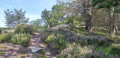
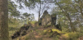
(1) Turn right. Head downhill, keep to the right and pass two rocky outcrops. Walk through the heather and follow the path to a Fork in the road.
(2) Keep to your right. Walk downhill to the Semois and continue to the right. Walk past the picnic tables.
(3) Continue along the Semois until you reach the road, then leave the signposted route.
No signposting
(4) Turn left, cross the bridge and continue along the Semois for 600 m until you reach a junction on your right, not far from a picnic table.
GR® signposting
(5) Turn right. Head uphill, cross an open stretch and, at the crossroads, carry on straight ahead for just over 700 m.
(6) Take a sharp right-hand bend before the cattle grid. Walk for about 650 m, ignoring the paths branching off on either side, until you reach a Fork in the road.
(7) Turn right, rejoin a path and continue to the right. Walk down this rocky section and turn right to explore the Castelain viewpoint. Retrace your steps and continue down to the road.
(8) Turn right and walk down to the bend.
(4) Head straight on along the forest track and walk to the forest track on your left, near the picnic tables. Leave the signposted route.
No Signposting
(3) Head uphill, staying on the main path. The path bends sharply to the right, then to the left, and leads to the road. Turn right and walk along the road with care. At the give way sign, keep to the right and head straight ahead along the dirt track to return to your car park (S/E).


 Visorando Member


 Difficult
  Easy
Easy