Country:

 City:
City:


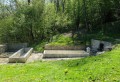
Car park behind Ornans cemetery, Rue du Taulet.
Yellow-Blue markings (some sections unmarked).
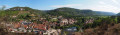
(S/E) Turn left as you leave the car park, with superb views of Ornans Castle and the Mont rock face already on display. At the first junction, continue straight on along Rue des Queuteux. After No. 56, climb the steps on the left. At the top of the steps, turn left onto the gravel path, which offers a 180° view of the Ornans rocks.
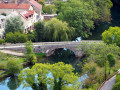
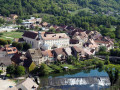
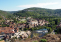
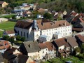
Just before you reach the departmental road, look out for the staircase on the right which climbs the hillside towards the Roche Fournièche (signpost). At the top of the wooden and stone steps, at the fork, turn left to reach the first viewpoint overlooking Ornans, its former Visitandines convent, the old Nahin bridge, the Château, the Roche du Mont and its Virgin, the Roche Botine, the Roche Lahier and the Loue Valley.
(1) Continue climbing along the narrow path that runs alongside the cliffs. At a bend, you’ll join a stony track which you follow for a few metres (towards Roche d’Ully) before leaving it immediately and resuming a signposted path leading up through the forest to the left.
After climbing a small rocky hillock, carry on straight ahead at the path junction. The markings have disappeared. You’ll come to a cleared area, no doubt due to bark beetle damage, which is a sorry sight. The path turns 90° to the right. At the far end of the cleared area, climb the hillside again at a 90° angle to the far left along a path that isn’t all that easy to spot, but if you look up, you’ll see some rocks to guide you.
(2) At the foot of the rocks, climb the ladder. The path then runs alongside the cliffs and you’ll reach the Roche d’Ully viewpoint. Turn back to the bottom of the ladder. You’re now entering the wildest part of the walk.
(2) Continue along these lovely little wild cliffs via a path that isn’t always visible and which sometimes disappears. But don’t worry – keep the cliffs close on your left. You’ll soon reach a narrow passage between the rocks. Squeeze through this passage, climbing carefully above the cliffs. This is the tricky bit of the route.
On the nearby ridge, you’ll come to a moss-covered rocky step about a metre high, which gradually gets narrower. Climb it without difficulty. Head slightly diagonally to the right, following red paint marks (which may have faded) lining a narrow path that runs along the ledge for about thirty paces. The path is easy to follow, drawing closer to the ledges and leading to an unsecured viewpoint overlooking the small Lachenaud cirque.
(3) Continue along the path, passing a crevice and a cave. The path becomes stony and wider, descending to the right towards the valley. It then climbs back up to the far left, passing a scree slope, and joins a wide stony track which you follow down to the right to reach a crossroads, where you’ll find the signposting again.
Head down to the right and, at the nearby fork, continue down to the left along the wide gravel path for 300 metres. Don’t miss the path that climbs up into the Châtelet woods on the left. It soon forks. Carry on climbing to the left, where you’ll come across the first signpost on the nature trail, featuring a quote about nature. A little further up, at an information board, you’ll reach a stony track; follow it uphill to the left (marked with a small squirrel symbol). This is an old trade route where carts with iron-rimmed wheels, laden with salt, have left ruts.
(4) A little further up, take a grassy path to the right (forest sign no. 49 hidden in the foliage and a ‘Roche du Châtelet’ sign facing away from the direction of travel). You’ll walk alongside the fitness trail and, soon, reach a bench for a short break. You’ll arrive at the viewpoint, then descend carefully using the handrails.
At the bottom of the steps, turn left (towards Ornans), heading down between the barriers to enjoy the view of the town of Ornans once more, and cross the Champ du Cerf Conservation Orchard. Head towards the viewing platform and go down one of the staircases.
(5) Follow the gravel path on the right to the orchard car park. Turn right towards the entrance to the nature trail. At the ‘Formation du Vallon’ sign, leave the ‘écureuil’ trail and head back up to the left along the gravel path which leads to a signpost; continue along the stony path opposite towards La Roche Fournièche to rejoin the original staircase and the cemetery (S/E).
 The route includes ledge paths and unsecured viewpoints. The paths are rocky and slippery in places. Sturdy footwear is essential and the use of walking poles is recommended.

 Visorando Member

 Very difficult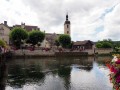
 Moderate