Country:

 City:
City:



Park in the car park at Place Charles-de-Gaulle
(S/E) With your back to the post office, cross the car park and then the public garden. Turn left towards the 15th-century castle and go under the porch and past the towers. Follow the road towards the stadium for 300 metres until you reach the storm basin, taking the left fork at each intersection.
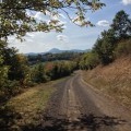
(1) Turn left onto the path along the houses and cross Rue du Champ de l'Allée. Continue straight ahead on the plateau (view of the Chaîne des Puys). At the first crossroads, continue straight ahead.
(2) At the second crossroads, follow the grassy path straight ahead. At the radio relay station, take the tarmac path on the right. At the fork, turn left and continue straight ahead until you reach the crossroads near a power line.
(3) Take the path on the right (signposted "Plateau de Lachaud") to the tarmac road. Continue straight ahead and slightly to the left until you reach the Rovère cross.
(4) At the cross, you can go to Puy de Marcoin by taking the path on the right (round trip: 15 minutes). Otherwise, go down opposite, cross and follow the stream to the T-junction with a tarmac road (crossroads of 2PR® - yellow markings).
(5) Turn right and walk 700 metres along the road. At the fire hydrant, turn right towards Les Ratiers (view of Tournoël Castle) then continue straight ahead.
(6) Cross the Ruisseau de la Rivaux stream and continue straight ahead, passing under a power line.
(7) Just before reaching the road, continue along the path on the right. When you see the houses of Marsat, take the hairpin bend to the right. Cross the Mirabel stream near an orchard.
(8) About 150 metres after crossing the stream, climb up a stony path on the left to the top and a T-junction.
(9) Turn left, ignore a path on the right, descend to a fork and then climb up to the right.
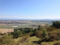
(10) At the five-way crossroads, continue straight ahead (view of Riom and La Limagne). Continue straight ahead. Pass the Vergnes farm and the old Roman road on your left and climb up between the farm buildings. Follow the wide path.
(11) At the junction with a tarmac road, take a sharp right turn (signposted "Parc Mirabel") and follow this road. At Mirabel, enjoy views of Limagne, the Montagne Bourbonnaise and the Monts de la Madeleine. Walk alongside the leisure park, then cross through deciduous trees and a vineyard on the hillside. Continue through the undergrowth on a path lined with low stone walls. On the plateau, enjoy views of the Chaîne des Puys.
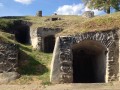
(12) Going downhill, take a path on the left under the oak trees (view of Châteaugay, the Puy de Dôme, Clermont-Ferrand and the Gergovie plateau). At the junction with a wide path, go downhill to the left. The path leads back to the village. When you reach Rue des Caves, you can see the Châteaugay wine cellars on the right.
(13) Continue on the right along Rue du Chalard, then continue along Rue du Pont de l'Étang. Return to the starting point by following the road you took on the way there on the left (S/E).

 Visorando Member
 Easy
Easy