The hidden village of Tiscali

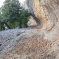
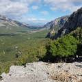
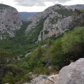
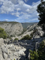
A ruined village sheltered by a rock arch, made all the more impressive by the approach walk through unspoilt countryside – this is the discovery you’ll make after crossing a pass, descending into a valley and climbing the next slope. As a bonus, there’s a magnificent view over a third valley.

Details

28101372
Creation:
Last update:
Last review:
  • Walking
    Activity: Walking
  • ↔
    Distance: 5.98 mi
  • ◔
    Average duration: 4h 25 
  • ▲
    Difficulty: Moderate

  • ⚐
    Back to start: Yes
  • ↗
    Ascent: + 1,939 ft
  • ↘
    Descent: - 1,942 ft

  • ▲
    Highest point: 1,591 ft
  • ▼
    Lowest point: 620 ft

Photos

Description of the walk

To reach the starting point, take the SS 125 road from Dorgali heading south. It is 1 km from the tunnel leading to Cala Gonone. Then leave the SS 125 and turn right onto a small, unmarked road that descends steeply into the valley. Discreet signs point to Tiscali and Gorropu after the junction. Continue south, follow the signs for the Sa Barva car park and park there (charge applies; campervans and vans are permitted).

(S/E) Leave the car park heading south and cross the bridge. Ignore the turn-off for Gorropu on the left and follow the track northwards to the Surtana car park.

(1) Leave the track and turn left onto a path (No. 481) heading towards the mountain. The path climbs through the scrubland, winding slightly, sometimes over rocks as at Scala de Surtana. The gradient eases as you reach a shaded gorge at Palas de Puntales.
(2) Ignore path 487, which branches off to the right, and continue on to Iscala e Cucutos.

(3) Ignore path 482, which branches off to the left, and continue along path 481, which descends to a more open area known as Dolovèrre.

(4) At this junction (a sign also indicates Trail No. 411), turn left, heading south, to continue along Trail 481, which begins to climb. When it reaches the cliffs, look out for a rock shelter: Pala Uporo.

(5) The path climbs westwards then north-westwards to the ridge, where it turns sharply left and leads to the entrance to the Triscali archaeological site (entrance fee payable in cash), after a very steep rocky section.
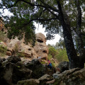
The visit to the site (low walls and a ruined house) is not shown on the route map.

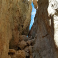
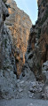
(6) Once you have visited the site, this walk continues to a narrow gorge and a viewpoint. To do this, return to the site entrance and take path 410 (towards the Sa Curtigia 'e Tiscali gorge) heading west for a few metres, then follow a cliff face south-west. You will reach the Sa Curtigia 'e Tiscali gorge, which you must pass through to continue the route.

(7). From the signpost you’ll come across after passing through the gorge, head down the same Path 410 to a rock slab where the path takes a hairpin bend.

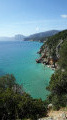
(8) From this rock slab, you can admire the magnificent Lanaitho valley. This marks the end of the walk. The return journey follows the same route back to the starting car park, following the signs for Ponte S’Abba Arva. Just after this bridge, you’ll reach the Sa Barva car park (S/E).

Waypoints

  1. S/E : mi 0 - alt. 666 ft - Sa Barva car park
  2. 1 : mi 0.66 - alt. 623 ft - Surtana car park – Surtana sign
  3. 2 : mi 0.95 - alt. 1,014 ft - Palas de Puntales
  4. 3 : mi 1.11 - alt. 1,112 ft - Iscala and Cucutos
  5. 4 : mi 2.1 - alt. 794 ft - Dolovèrre
  6. 5 : mi 2.31 - alt. 1,030 ft - Pala Uporo
  7. 6 : mi 2.63 - alt. 1,316 ft - Entrance to the Tiscali site
  8. 7 : mi 2.88 - alt. 1,591 ft - Sa Curtigia 'e Tiscali
  9. 8 : mi 2.99 - alt. 1,339 ft - Rock slab – Viewpoint
  10. S/E : mi 5.98 - alt. 666 ft - Sa Barva car park

Notes

No water available. There is a small shelter under a rock at the bend between (4) and (5).
Wear walking boots.
The paths are mainly stony with a few sections over steep rocks.
In wet weather, the site may be closed and the limestone on the paths becomes slippery.
At the time of the walk, in October 2022, there were signs at every junction as well as red-and-white markings all along the path.
Make sure you have cash to pay the site entrance fee: 6 euros in June 2026.

Worth a visit

During the walk, look out for the old markers carved into some of the rocks: a triangle inside a circle.
It is possible to complete a circular route starting from point (8). To do this, continue along path 410 until the junction on the right with path 411, which leads to point (4) Dolovèrre. The views are less spectacular, however: the return walk between (4) and (8) offers some very fine views that are well worth seeing from both directions.
Trails 487 (2) or 482 (3) allow you to extend the walk by heading to points (4) or (7) respectively. Similarly, trail 480A (5) takes you to point (7).
From the Sa Barva car park (S/E), you can head to the Gorropu Canyon.
The Lanaitho Valley is the other route to the hidden village of Tiscali, and the trail is easier.
Nearby, you can visit the Sorgente Su Gologone resurgence downstream of the Lanaitho Valley, as well as Cala Gonone and the Gulf of Orosei.

Reviews and comments

4.5 / 5
Based on 8 reviews

Reliability of the description
4.5 / 5
Ease of following the route
4.4 / 5
Route interest
4.6 / 5
mantix
mantix
• Edited:

Thank you for the clarifications and the water. I’ve updated the listing to reflect the price of 6 euros in June 2026. Let’s not forget that you’ll need cash. If you could let me know where you found it difficult to follow the description and the GPX track, I’ll be able to make the necessary corrections. Thank you.

Machine-translated

Jmi26
Jmi26

Overall rating : 4.3 / 5

Date of your route : Jun 10, 2026
Reliability of the description : ★★★★☆ Good
Ease of following the route : ★★★★☆ Good
Route interest : ★★★★★ Very good
Very busy route : No

A very challenging route. Some quite difficult sections. This is the toughest route to reach the site. Make sure you take plenty of water with you. The Tiscali site is stunning, more for its geological features than for the rather modest ruins. You can enjoy a picnic in the cool shade there, which is lovely! Entry to the site costs €6, payable on arrival.
However, we didn’t complete the final climb. It was too hot, even for early June.

Machine-translated

mantix
mantix

Excellent idea to go to the top.

Machine-translated

Philippe  Pagès
Philippe Pagès

Overall rating : 5 / 5

Date of your route : Feb 25, 2026
Reliability of the description : ★★★★★ Very good
Ease of following the route : ★★★★★ Very good
Route interest : ★★★★★ Very good
Very busy route : No

Hike along a magnificent route. Just avoid going to point 8: there is little point in reaching this slab. It is better to climb from point 7 to Monte Tiscali, where you will enjoy a 360-degree panorama.

Machine-translated

User 23774474

Overall rating : 5 / 5

Date of your route : Sep 11, 2025
Reliability of the description : ★★★★★ Very good
Ease of following the route : ★★★★★ Very good
Route interest : ★★★★★ Very good
Very busy route : Yes

I recommend returning via the path that goes around the top of the hill where the ghost village of Tiscali is located, which offers beautiful views of the other valley

Machine-translated

mantix
mantix

That's a shame. I hope you made it to the end of the walk. The gpx track is sometimes useful.

Machine-translated

Renaud 29460
Renaud 29460

Overall rating : 3.7 / 5

Date of your route : Apr 21, 2025
Reliability of the description : ★★★★☆ Good
Ease of following the route : ★★★☆☆ Average
Route interest : ★★★★☆ Good
Very busy route : Yes

At the very start of the 481, we got lost going left instead of straight ahead.

Machine-translated

mantix
mantix

Not nice guards! I hope you made it as far as the fault. For future hikers, don't forget that you can make a loop by continuing downhill past the fault.

Machine-translated

AgatheVllx
AgatheVllx

Overall rating : 4 / 5

Date of your route : Jun 29, 2024
Reliability of the description : ★★★★☆ Good
Ease of following the route : ★★★★☆ Good
Route interest : ★★★★☆ Good
Very busy route : No

A pleasant hike in the hinterland with beautiful views.
As indicated, bring closed shoes and water.
IMPORTANT: Payment for entry to the village is IN CASH only, so we missed out on this information and were unable to visit.

Machine-translated

mantix
mantix

Well done, because if it's hot the climbs must be exhausting. Did you go as far as the fault and the viewpoint over the north valley?

Machine-translated

camver
camver

Overall rating : 5 / 5

Date of your route : Jun 23, 2024
Reliability of the description : ★★★★★ Very good
Ease of following the route : ★★★★★ Very good
Route interest : ★★★★★ Very good
Very busy route : Yes

Hiking on 19/06/24 in stifling heat (35 degrees and high humidity). In these conditions, it's vital to drink enough water (at least 2 litres per person).
Pleasant walk, nice hidden village, beautiful scenery.
Correct footwear required, moderate difficulty, varied scenery.
The return to the car park, with its uphill false flat, is not to be underestimated... especially in the heat!

Machine-translated

TheWaxmanTeam
TheWaxmanTeam

Overall rating : 4.7 / 5

Date of your route : Aug 07, 2023
Reliability of the description : ★★★★★ Very good
Ease of following the route : ★★★★☆ Good
Route interest : ★★★★★ Very good
Very busy route : No

Superb walk in the peace and quiet away from the crowds!
Short video of our walk!

Machine-translated

mantix
mantix

As I wrote, you have to pay to park and visit the site. And I also wrote that there was no water. You confirm that there has been no change. I hope you went as far as the fault, if not you can get there via the other valley, as indicated in the information sheet, it's nice too. All the best.

Machine-translated

PhK
PhK
• Edited:

Overall rating : 4.3 / 5

Date of your route : Sep 29, 2023
Reliability of the description : ★★★★☆ Good
Ease of following the route : ★★★★★ Very good
Route interest : ★★★★☆ Good
Very busy route : No

Not very difficult, as long as you don't forget your water. There are no water points on the route. Be careful, it's not very difficult to find your way around, but there is a serious climb at the start, followed by a flat walk, followed by another climb to finish on a plateau! So for older people like me (70), take it easy. The tour of the village is quick but interesting and doesn't last long. Which means that if you come back down immediately afterwards (as we did), you'll have made a 4-hour effort. Italian fashion dictates: one ticket to pay for the car park and a second ticket to pay for at the top of the cliff! A friendly Italian waits for you and asks for €5 again.

Machine-translated

Other walks in the area

For more walks, use our search engine .

The GPS track and description are the property of this route's author. Please do not copy them without permission.