The Fort du Salbert as seen from Châlonvillars

A short walk offering a chance to see structures dating from the late 19th century: an old lock, followed by Fort Salbert and its gun batteries, all set amongst meadows and pretty woodlands without any particular difficulties. Recommended as a way to get back into walking after the winter break or as a family outing to fill an afternoon.

Details

44166351
Creation:
Last update:
Last review:
  • Walking
    Activity: Walking
  • ↔
    Distance: 4.78 mi
  • ◔
    Average duration: 3h 05 
  • ▲
    Difficulty: Easy

  • ⚐
    Back to start: Yes
  • ↗
    Ascent: + 978 ft
  • ↘
    Descent: - 951 ft

  • ▲
    Highest point: 2,129 ft
  • ▼
    Lowest point: 1,234 ft

Photos

Description of the walk

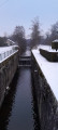
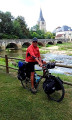
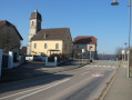
Head to Chalonvillars via the D619. At the junction with the traffic lights, follow signs for ‘La Forêt’. Cross the canal at the lock and park on the central reservation.

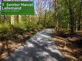
(S/E) Follow the gently ascending path for 200 metres, marked with red and whiteGR®5(E2) signs alongside a Blue Triangle.

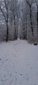
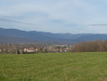
(1) Leave theGR® on your right – this will be the return route – and continue along the Blue Triangle path. After a tricky section which may be icy depending on the season, continue across the meadows to reach a small housing estate. Cross the first road and continue along the pastures to reach the hamlet of La Forêt.

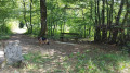
(2) Once you reach the tarmac road, 50 m after the bend, turn right and follow the path which climbs into the forest, now signposted with a Green Triangle. You must then turn left and follow an old ditch, which you will cross a little further on.

(3) Cross the first logging track, then continue along the path, which is still signposted with a Green Triangle.

(4) At the junction, head straight on along the path, now signposted with a Blue Disc.

(5) When you reach a second track, turn left and follow the Yellow Ring markings, which circle the fort clockwise from the north. Join theGR®5, which climbs up from Évette, and continue for about fifty metres.

(6) Turn right (Red Rectangle markings crossed with white, with a red and yellow stripe) and climb up to the first ditch.

(7) Take the footbridge on the right which crosses the ditch, then the flight of steps to reach the summit platform overlooking the fort’s inner courtyard, which offers an almost 360° view. Several orientation boards help you get your bearings. First to the north towards the Ballons des Vosges, then to the south with the whole of Belfort at your feet, Montbéliard and a view stretching as far as the Bernese Alps, and finally to the west towards the Haute-Saône. Sorry, but on the day of the walk, thick fog meant it wasn’t possible to take photos of the distant views.
At the end of the viewing platform, go down the stairs on the left.

(8) At the bottom of the stairs, turn left again. Walk past the entrance to the fort, which is rather unsightly with its graffiti and gives the place a rather sinister feel. Further on, walk alongside the site of the eastern battery with its cross-braced shelters and the remains of an observation post resembling fake Roman ruins.

(9) After the barrier, you can let the children play on the playground at the back of the car park or head down to the right (your choice of route), continuing to follow the red and white markings ofthe GR® 5, which you’ll follow all the way back to the car park. The descent through the forest is easy and pleasant.

(10) Do not cross the access road to Le Salbert; instead, take the lovely forest road on the right.

(11) At the junction, go straight on, then turn left and continue to the turning area at the end of the forest road.

(12) First turn right then left to continue: on the left are the ruins of an old battery. Continue down through the woods to rejoin the original three-way junction.

(1) Continue down the slope to reach Chalonvillars and the lock (S/E).

Waypoints

  1. S/E : mi 0 - alt. 1,234 ft - Lock No. 1 of the - Canal de Montbéliard à la Haute-Saône
  2. 1 : mi 0.15 - alt. 1,329 ft - Crossing the circular loop
  3. 2 : mi 0.52 - alt. 1,276 ft - Hameau de la Forêt (D218a)
  4. 3 : mi 1.32 - alt. 1,650 ft - Forest track
  5. 4 : mi 1.68 - alt. 1,847 ft - Junction
  6. 5 : mi 2.04 - alt. 1,991 ft - Yellow Ring crossroads
  7. 6 : mi 2.36 - alt. 2,011 ft - Turn right
  8. 7 : mi 2.42 - alt. 2,077 ft - Footbridge and steps
  9. 8 : mi 2.55 - alt. 2,093 ft - Entrance to the - Fort du Salbert (Belfort)
  10. 9 : mi 2.75 - alt. 2,067 ft - Barrier
  11. 10 : mi 3.04 - alt. 1,775 ft - Turn-off onto the access road to Le Salbert (D4)
  12. 11 : mi 3.58 - alt. 1,640 ft - Crossroads
  13. 12 : mi 3.93 - alt. 1,647 ft - End of the forest road and ruins of the battery
  14. S/E : mi 4.78 - alt. 1,234 ft - Lock No. 1 of the - Canal de Montbéliard à la Haute-Saône

Notes

No special equipment required.
If caught in heavy rain, you can take shelter in the cave shelters at the summit.

Worth a visit

Visit the nearby NATO museum, situated along the access road to Salbert (open in summer. See the website: ouvrage-g.com/visites/

Fort du Salbert

The defeat of 1870–1871 and the resulting annexation of Alsace, and part of Lorraine, brought the German border dangerously close to Belfort. The entire fortification system along the eastern border had to be reviewed.
General Séré de Rivières was put in charge of this task. He established a system of defensive lines and strongholds designed to prevent an invasion similar to that of the summer of 1870. Belfort and its surrounding region underwent a considerable strengthening of the existing fortifications, alongside the construction of a whole series of new forts and fortifications. Fort Salbert, situated on the hill of the same name overlooking Belfort at an altitude of 650 metres, was named Fort Lefèbvre, after the Marshal of the Empire. It was built between 1874 and 1877. It is polygonal in shape, surrounded by moats defended by caponiers. It could accommodate a garrison of 680 men. The rampart armament consisted of 25 guns and 7 mortars, whilst the flanking defences comprised 12 guns installed in the caponiers. Two signal posts enabled communication with the citadel and the surrounding forts. Its purpose was to protect the stronghold of Belfort and the forts surrounding it, the road to Lure and the Belfort–Lure railway line. The fort is currently privately owned by the town of Belfort. It was leased to an association (ATOMES) with the aim of maintaining it and opening it to the public, but the project unfortunately fell through. Indeed, following countless acts of vandalism, the association was forced to give up.
Between 1953 and 1957, a major radar station was built at Le Salbert for NATO purposes, making extensive use of the old fortifications: the fort was used as barracks, whilst huge underground premises housing the technical installations and an air defence operations room were fitted out on the site of a former cave shelter. An underground passageway carved into the rock connects the two facilities. A museum has also been set up there. It is open to the public during the summer. See the website: ouvrage-g.com/visites/

Lock No. 1

Following the loss of Alsace and part of Lorraine in 1870, it became necessary to establish a waterway link between the industrial region of Montbéliard and the industrial regions of French Lorraine. To ensure speed, this link was designed to bypass Dole and Gray, arriving directly in the vicinity of Port-sur-Saône. Starting from the Rhône–Rhine Canal towards Fesches-le-Châtel (25), the new waterway served Bavilliers and Essert, where a port was to be built. It then crossed the eastern part of Haute-Saône (Frahier, Champagney, Ronchamp and its coalfield) to reach Lure, before following the Lanterne valley to rejoin the Saône at Conflandey.
The leat, fed by the Champagney catchment, stretched for 10 km at an elevation of 374.75 metres between the Beuveroux lock on the western side at Champagney and Lock No. 1 on the eastern side at Chalonvillars.
The return of Alsace-Lorraine to France following the victory of 1918, which allowed traffic through Alsace to resume, made the project less attractive, particularly as coal production at the Ronchamp mines was declining.
On the eastern side, only the section between Fesches-le-Chatel and the port of Bottans was opened to navigation. As for the western section, with the exception of the Beuveroux lock at Champagney, no work was undertaken – not even the land acquisitions required for the canal right-of-way.
The canal has been decommissioned for navigation since 2018 but is nevertheless used to supply water to the Rhône–Rhine Canal from the Champagney Reservoir, then via a channel between Bavilliers and Montreux-Château.

Always be cautious and plan ahead when you're outdoors. Visorando and the author of this route cannot be held responsible for any accidents occurring on this route.

The GR® and PR® markings are the intellectual property of the Fédération Française de Randonnée Pédestre.

Reviews and comments

5 / 5
Based on 2 reviews

Reliability of the description
5 / 5
Ease of following the route
5 / 5
Route interest
5 / 5
Sandra25200
Sandra25200

Overall rating : 5 / 5

Date of your route : Jul 01, 2024
Reliability of the description : ★★★★★ Very good
Ease of following the route : ★★★★★ Very good
Route interest : ★★★★★ Very good
Very busy route : No

Very well explained
The view from the fort is simply breathtaking.
Please note: the paths can be uneven and slippery during forestry work and in wet weather.

Machine-translated

Cracos
Cracos
• Edited:

Overall rating : 5 / 5

Date of your route : Feb 26, 2024
Reliability of the description : ★★★★★ Very good
Ease of following the route : ★★★★★ Very good
Route interest : ★★★★★ Very good
Very busy route : No

A lovely half-day walk.
Watch out for logging operations during the felling season (the paths may be damaged by heavy machinery).
A visit to the summit of Salbert is a must when visibility is good.

Machine-translated

Other walks in the area

For more walks, use our search engine .

The GPS track and description are the property of this route's author. Please do not copy them without permission.