From Prat d’Albis to the Pic de Razels via the Rocher de Batail

A very beautiful ridge walk, without any difficulty, suitable for both summer and winter, with quick access from Foix.

Details

68489792
Creation:
Last update:
Last review:
  • Walking
    Activity: Walking
  • ↔
    Distance: 14.04 mi
  • ◔
    Average duration: 9h 00 
  • ▲
    Difficulty: Very difficult

  • ⚐
    Back to start: Yes
  • ↗
    Ascent: + 2,969 ft
  • ↘
    Descent: - 2,956 ft

  • ▲
    Highest point: 5,584 ft
  • ▼
    Lowest point: 4,662 ft

Photos

Description of the walk

Access by car from Foix, heading towards Prat d’Albis. Drive past the paragliders’ car park and the radio masts to park before the barrier blocking the road.

(S/E) Follow the road to reach the ridge to the west of Bout de Touron.

(1) Leave the road at the bend and follow the ridge path due west.

(2) Cross the Pas de Bazillac, continue along the path that runs along the southern flank of the Sommet de Bazillac and reach a junction.

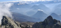
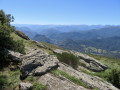
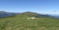
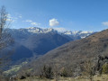
(3) Leave the path leading to the Picou on your right and continue along the ridge to reach the Rocher de Batail at an altitude of 1,715 metres, the highest point of the walk. Beautiful 360° views over the Pyrenees mountain range and the Garonne plain.

(4) Continue along the ridge to reach the foot of the Sarrat de la Pelade: it is possible to go round it on the right, but this is a longer route.

(5) Carry on straight ahead to pass to the south of this small peak and reach the junction for the Pech de Therme.

(6) Leave the summit on your right and follow the path, keeping in the same direction. You’ll reach the Roc Blanc.

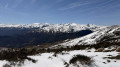
(7) Ignore the path on the left which winds down to the Col de Port and carry on straight ahead. Cross a beautiful forest, which is snow-covered in winter, and reach the Pic de Razels: a magnificent 360° view. You can see the Cap de Carmil to the west and the Vallier to the south-west.

(8) Follow the ascent route in the opposite direction to return to the car park (S/E).

Waypoints

  1. S/E : mi 0 - alt. 4,662 ft - Car park before the barrier
  2. 1 : mi 0.42 - alt. 4,754 ft - Junction
  3. 2 : mi 1.38 - alt. 4,780 ft - Pas de Bazillac
  4. 3 : mi 2.56 - alt. 5,338 ft - Picou junction
  5. 4 : mi 3.2 - alt. 5,584 ft - Rocher de Batail (1716 m)
  6. 5 : mi 4.19 - alt. 5,561 ft - Sarrat de la Pelade
  7. 6 : mi 5 - alt. 5,344 ft - Pech de Therme junction
  8. 7 : mi 5.71 - alt. 5,036 ft - Roc Blanc (1542 m)
  9. 8 : mi 7.02 - alt. 5,220 ft - Pic de Razels (1600 m)
  10. S/E : mi 14.04 - alt. 4,662 ft - Car park before the barrier

Notes

In winter, bring snowshoes for the snow-covered and steep sections.

Reviews and comments

5 / 5
Based on 2 reviews

Reliability of the description
5 / 5
Ease of following the route
5 / 5
Route interest
5 / 5
Gab M
Gab M

Overall rating : 5 / 5

Date of your route : Apr 27, 2026
Reliability of the description : ★★★★★ Very good
Ease of following the route : ★★★★★ Very good
Route interest : ★★★★★ Very good
Very busy route : Yes

This route is truly magnificent, where the mountains meet the plains!

Machine-translated

CANOPE
CANOPE

Overall rating : 5 / 5

Date of your route : May 05, 2025
Reliability of the description : ★★★★★ Very good
Ease of following the route : ★★★★★ Very good
Route interest : ★★★★★ Very good
Very busy route : Yes

A lovely walk on a clear day.

Machine-translated

Other walks in the area

For more walks, use our search engine .

The GPS track and description are the property of this route's author. Please do not copy them without permission.