


Circular around Sassolungo


A beautiful circular loop without any lifts, but for experienced mountaineers. The first descent is quite slippery with gravel. The first ascent is a winding path. Some areas may be snow-covered all year round. Follow paths 525 and then 526 carefully.
Details
Creation:
Last update:
Last review:
–
–
-
 Activity: Walking
 -
 Distance: 6.11 mi
 -
 Duration according to the author: 5 hrs
 -
 Difficulty: Very difficult
 -
-
 Back to start: Yes
 -
 Ascent: + 2,283 ft
 -
 Descent: - 2,287 ft
 -
-
 Highest point: 8,780 ft
 -
 Lowest point: 6,772 ft
 Country:

 City:
City:


Waypoints
- S/E : mi 0 - alt. 7,172 ft - Furcela de Saslonch
- S/E : mi 6.11 - alt. 7,175 ft - Furcela de Saslonch
Other walks in the area
Col Raiser Seceda
 Visorando Member
 11.03 mi
+3,855 ft
-3,842 ft
8h 25
11.03 mi
+3,855 ft
-3,842 ft
8h 25
 Difficult
 Departure from Santa Cristina Gherdëina - St. Christina in Gröden - Santa Cristina Valgardena (South Tyrol)
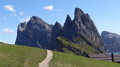
A superb hike in the Puez Geisler Odle Nature Park, a UNESCO World Heritage Site. This route offers magnificent panoramic views at the foot of the Fermeda, Sass Rigais and Furchetta peaks.
At Seceda, a promontory high above the void, you'll witness a spectacular alignment of these peaks, posing for you. At various other points on the loop, you'll enjoy marvellous panoramic views of the Langkofel, Schlern and Sella massifs.
Loop around the Sella massif from Boè
3.04 mi
+1,394 ft
-1,375 ft
2h 35
 Moderate
Departure from Corvara in Badia - Corvara (South Tyrol)
Moderate
Departure from Corvara in Badia - Corvara (South Tyrol)
This circuit on the eastern slope of the Sella massif is a very accessible loop hike with minimal elevation gain and no major technical difficulties. However, you do need to be in good physical shape. Geologically speaking, it's really cool because the hike passes through rock formations typical of the Dolomites and offers breathtaking views.
On the Seceda via Pieralonga and the Firenze Refuge
 6.13 mi
+1,657 ft
-1,654 ft
4h 15
Moderate
Departure from Santa Cristina Gherdëina - St. Christina in Gröden - Santa Cristina Valgardena (South Tyrol)
6.13 mi
+1,657 ft
-1,654 ft
4h 15
Moderate
Departure from Santa Cristina Gherdëina - St. Christina in Gröden - Santa Cristina Valgardena (South Tyrol)
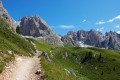
This hike in the Puez Odle Nature Park is truly enchanting. The wave-shaped summit of Seceda is known throughout the world and its viewpoint will delight your eyes. The rest of the hike offers different views of Val Gardena and the famous pink colour of its mountains.
Saltria
 6.59 mi
+938 ft
-938 ft
3h 50
Moderate
Departure from Kastelruth - Castelrotto (South Tyrol)
6.59 mi
+938 ft
-938 ft
3h 50
Moderate
Departure from Kastelruth - Castelrotto (South Tyrol)
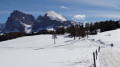
Compatsch is the gateway to the Alpe di Siusi. This mountain pasture, the largest in Europe, offers a breathtaking view of the Dolomites in South Tyrol, Italy. The panorama in the foreground stretches from the Schlern massif, including Punta Santern, to the Langkofel Group, featuring the Langkofel and the Plattkofel. In the distance lie the Sella massif with Piz Boé, and the Geisler massif with Seceda and Saas Rigais. This circular route offers magnificent views of these ‘bellissime montagne delle Dolomiti’.
Ride in the western part of the Alpe di Siusi, Seiser Alm
7.86 mi
+1,250 ft
-1,253 ft
4h 40
Moderate
Departure from Kastelruth - Castelrotto (South Tyrol)
To the west of the Dolomites, just above the Isarco Valley, there is a rather surreal place. Imagine a plateau covering several thousand hectares, with undulating terrain between 1,800 and 2,400 metres above sea level, almost completely devoid of trees, and dotted with hundreds of alpine barns. And all this is surrounded by several Dolomite massifs rising to over 3,000 metres. Here you can give free rein to your wanderlust, and the suggested route is the one we took to discover the area.
Villnösstal: from Zans to Malga Gampen
4.19 mi
+1,283 ft
-1,283 ft
3h 05
 Easy
Departure from Villnöß - Funes (South Tyrol)
Easy
Departure from Villnöß - Funes (South Tyrol)
Val Di Funes/Villnösstal is a little paradise at the foot of the Odle mountains. This valley, home to the famous mountaineer Reinhold Messner, is off the beaten track. Passing by the foot of the vertiginous cliffs, you can understand how the vocation of one of the greatest conquerors of the peaks came about. And the bucolic setting of this valley also explains why he puts so much energy into defending a natural mountain.
Some places have several names: Val di Funes/Villnösstal, Zannes/Zans, GampenAlm/Malga Gampen
Vajolet Pass at Carezza
 6.44 mi
+2,251 ft
-3,875 ft
4h 55
Moderate
Departure from San Giovanni di Fassa - Sèn Jan (Provincia di Trento)
6.44 mi
+2,251 ft
-3,875 ft
4h 55
Moderate
Departure from San Giovanni di Fassa - Sèn Jan (Provincia di Trento)
After starting on an easy path, sometimes lined with pine trees, you’ll cross the Rosengarten/Catinaccio rock massif via a steep path that presents no technical difficulty. You’ll climb alongside Via Ferrata enthusiasts, whom you’ll leave behind at the pass. A whole new landscape then opens up before you. The route continues through a greener, less steep landscape.
Circular around Castelrotto via Schafstall
6.46 mi
+1,969 ft
-1,969 ft
4h 40
Moderate
Departure from Kastelruth - Castelrotto (South Tyrol)
Start and finish at the village cable cars with some lovely views around Casterotto.
A beautiful, fairly steep climb alongside the cable cars through pastures, then into the woods for most of the ascent. Very pleasant on a hot, sunny day.
No great difficulty until you reach the highest point of this circular. There are small inns to choose from in Marinzen or at the Schafstall hütte.
There is a slight variation from the route shown on tourist maps when descending towards St Michael. The descent is quite steep.
The rest of the route follows a tarmac road with no traffic, passing through a charming hamlet with beautiful views of the mountains and the village.
10 km in total and a variety of terrain that allows you to enjoy the whole route.
For more walks, use our search engine .
The GPS track and description are the property of this route's author. Please do not copy them without permission.

