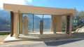
Circular loop around Lama

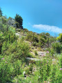
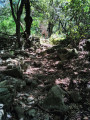
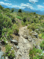
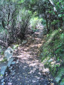
Pleasant circular path around the village of Lama. The path is very well maintained and features information boards about local life (thanks to the local council!). It is a stone path with some steps. Although it is not at all difficult, it is still advisable to wear walking shoes. 

Details

75345176
Creation:
Last update:
Last review:
  • Walking
    Activity: Walking
  • ↔
    Distance: 2.26 mi
  • ◔
    Average duration: 1h 50 
  • ▲
    Difficulty: Easy

  • ⚐
    Back to start: Yes
  • ↗
    Ascent: + 869 ft
  • ↘
    Descent: - 869 ft

  • ▲
    Highest point: 2,257 ft
  • ▼
    Lowest point: 1,526 ft
  • ⚐ Country: France
  • ⚐ City: Lama (20218)
  • ⚑
    Start/End: N 42.575792° / E 9.171366°
  • ❏
    IGN map(s): Ref. 4348OT
  • Hour-by-hour weather

Photos

Description of the walk

The start is from the last car park on the left on the climb up to the village, just before the ‘No entry except for residents’ sign. It is a shaded car park with around fifteen spaces. You should therefore plan to arrive early during the high season.

The walk starts via a flight of steps to the right of the toilets at the far end of the car park.

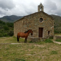
(S/E) Walk up through the village until you reach the church; go round it, then follow a series of steps and narrow alleyways that take you through the village. Continue north, cross the Funtana Bona stream and find the path on the other side heading towards Urtaca 

(1) Leave this path on your left and take the path opposite, which begins to climb gently in a circular pattern. Cross the stream again and you’ll reach a fountain.

(2) Turn left before reaching a house and continue the climb, which alternates between sections through the woodland and views of the maquis. Turn right, leaving the Funtana Bona stream behind.

(3) The climb continues, over steps and stone slabs, aided by an iron handrail. Monté Grossu is the highest point of this route, which has been prepared by the local council. There are large stone slabs where you can stop for a snack, provided you don’t mind the wind – from which you’ve been sheltered until now! Then begin the descent.

(4) Leave the path up to Monté Astu on your left and continue along the path on the right. Go down the steps which lead to a street.

(5) Follow this street to the left as it winds its way round a long bend, walk past the cemetery and, when you reach the church, turn left to reach the car park (S/E). 

Waypoints

  1. S/E : mi 0 - alt. 1,552 ft - Car park
  2. 1 : mi 0.44 - alt. 1,552 ft - Junction towards Urtaca
  3. 2 : mi 0.76 - alt. 1,703 ft - Junction
  4. 3 : mi 1.13 - alt. 2,159 ft - Ramp
  5. 4 : mi 1.39 - alt. 2,195 ft - Crossroads
  6. 5 : mi 1.83 - alt. 1,765 ft - Junction with the street
  7. S/E : mi 2.26 - alt. 1,552 ft - Car park

Notes

There are new and clean public toilets in the car park.

Reviews and comments

5 / 5
Based on 2 reviews

Reliability of the description
5 / 5
Ease of following the route
5 / 5
Route interest
5 / 5
Frederico
Frederico

Overall rating : 5 / 5

Date of your route : Sep 29, 2025
Reliability of the description : ★★★★★ Very good
Ease of following the route : ★★★★★ Very good
Route interest : ★★★★★ Very good
Very busy route : Yes

An easy hike, starting by going around the church on the right. Allow 1 hour for the climb. There are numerous information boards along the route explaining local customs. The car park is small, so arrive early. Toilets are available in the car park

Machine-translated

marix65
marix65

Thank you very much for your feedback. Yes, that was indeed the aim – to document the route signposted by the local council!
All the best
Marie

Machine-translated

mcd28
mcd28

Overall rating : 5 / 5

Date of your route : Jun 24, 2025
Reliability of the description : ★★★★★ Very good
Ease of following the route : ★★★★★ Very good
Route interest : ★★★★★ Very good
Very busy route : No

Very beautiful walk (which largely overlaps with a trail marked by the municipality, but it's very easy to find using Visorando).
Varied, with regular and interesting information panels (information partly taken from an ethnology book). Public toilets at the car park.
Thank you for this description and thank you to the municipality of Lama for the layout.

Machine-translated

Other walks in the area

For more walks, use our search engine .

The GPS track and description are the property of this route's author. Please do not copy them without permission.